
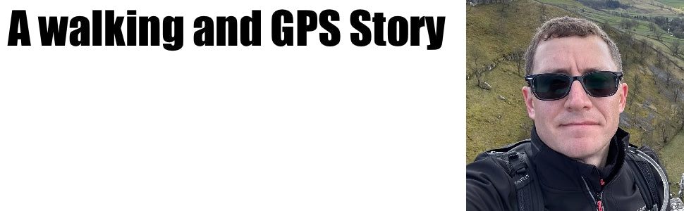

A Walking and GPS Story - Kevin
Kevin kindly shared his amazing personal story with us and also his GPS story. I hope you agree, it is a true story of real determination.
I have been a GPS handheld unit user since March 2023 that I purchased from GPS training and as such I have been keeping up with the content that you have been sending out by means of the e-mails and the website. I have also been listening to the GPS training Podcast and have been enjoying listening to the product reviews and the real world examples of where the units are being used. I have especially enjoyed the stories on there from the other walkers about their journeys and the achievements they have accomplished so that has compelled me to write out my story and send it in. Now it takes a while to get to the walking part so bear with this but the back story is important.
Now this story is not quite as dramatic as some of the others I have heard like walking the coasts of Great Britain, walking the length of Britain, and the ultra events and challenges that have been spoken about on there, mine is more about personal achievements after a life changing event, certainly not on the scale of the other events on the podcast, but I thought it might be worth sharing anyway.
It probably starts around late 2017, maybe early 2018. Back then I wasn’t a particularly healthy person, definitely overweight, not really exercising much, working too many hours and a not very good diet. October 2017 we’d had a bit of a disaster at work which I won’t go into details but it took a lot of effort to sort out and many times along the way put the company at quite a big risk so as expected that put a lot of stress on me. We eventually got that resolved by the end of March 2018 and it may be the wind down from that which caused the issues, combined with me not looking after myself.
At the end of May 2018 was when it happened, luckily I was at home with family around, I had started to notice a problem in my right hand, then arm, a numbness like really bad pins and needles, I thought I’d been sat in one place for too long and cut off some circulation so I tried to re-position myself my standing and my right leg gave out from under me and I went down there, I couldn’t move on that side. An ambulance was called and I was rushed to hospital, I had suffered a stroke brought on by a brain haemorrhage on the left side.
So initially I had very little, or difficult, movements all on my right hand side, mainly right leg and right arm. A bit more fortunately it no effect on my speech, or memory, or other brain activity so everything there was ok, it was just the mobility on the right. (Don’t worry, it gets better!)
My first week in hospital was mainly trying to get my blood pressure down, as it turned out it was extremely high and was most likely the cause of the problem. Accelerated by my bad health recent stresses, and, as it turned out, a history of high blood pressure in the family. One thing I will say here is always get things checked out. Before this I had been having a few headaches, I put it down to using screens at work, and of course being a stubborn man I didn’t want to get it checked by a doctor. Always get things checked as you never know, lessens learnt! The other part of this first week was trying to get some movement back. One of my favourite things is driving, going for drive somewhere or travelling so it’s quite scary to think something you really enjoy is going to be taken away, it all helps with the motivation. The doctors did seem positive at the time and that helped as well but the thought is always there that it wasn’t possible to recover.
Still, a lot of physical therapy and medication, and work, meant after about eight days I could move enough, (with aids) to go home. It certainly helped my mood just to be at home even though I needed a lot of help to get about. A massive thanks to the Team in the Stroke ward at Northampton General Hospital, doctors and nurses who got me to a point to be able to leave, and also to the ambulance teams who got me to the hospital on time, without which things could have been very different.
While at home I then needed more intense therapy, now this is where another big part of the credit goes. The Northamptonshire Community Stroke Team were a massive help, and were, for the most part, responsible for getting to the point where I am now. I couldn’t do it without them and the team were absolutely amazing.
The first eight weeks of being at home, with the help of the stroke team, they got me back on my feet properly, from having to walk with a frame and being helped up the stairs they had me walking independently and being able to function at home. I was also able to get outside and start some short walks near home. During this time I also managed to achieve the first massive goal being able and well enough to drive. I had started back to work after this first period, although from home for a few weeks, once I was able to drive again and walk on my own outside I was able to go back to work, on short hours to start but it was an indication that things could get back to some sort of normal.
For the next several months I continued to work with the Stroke Team to build my strength up and start to get as much mobility as possible.
Now into 2019 and a lot more recovery later, I then started to understand that I needed to sort my health out a lot more. I was back at work at this point, driving again and trying to get things back together. Still a long way to go to get fully back to normal, but certainly better. I certainly wasn’t going to have all this happen again. I had already improved my diet by a lot immediately after I left hospital. No more extra snacks, I was terrible for snacking into the evenings, better food at meal times and cutting down. I needed to get my blood pressure down, the cause of all this in the first place.
I found that early on to improve my leg and arm motion the Stroke Team had me doing short walks around home first, then around the local area and I was actually ok with that, partly it got me out of the house, and I was travelling a bit (ok, not very far) getting some fresh air etc. and I started to enjoy that, We also had an old exercise bike in the house, which I do use as well but I struggle a bit more with that, It’s quite tough on my weaker side and seemed to highlight I was out out balance and to be completely honest it’s quite boring trying to exercise in one spot, indoors and going nowhere. It was becoming obvious I wasn’t going to be able to cycle outdoors, where I wanted to be but the walking seemed to be ideal. The Stroke Team told me it was very good for me anyway, so this is really where the walking journey started. I did consider whether to push the exercising into running but it was clear that also wasn’t going to be possible as my right side simply can’t move quick enough or consistently enough to maintain a pace without damaging other limbs and muscles trying to compensate. So walking it was.
I continued with walking just locally, around my area, firstly just the immediate area where I live, then slightly further afield towards some woods and paths not far away, that felt a bit more proper outdoors, it helped to improve my mood immensely being out in the countryside. Now back at work pretty much full time as well at lunchtimes I was able to get out and walk an area near a river and canal, and a small lake. I started making the most of my lunch breaks getting out every day for a short walk. Even if the weather was not ideal I needed to make sure I was getting out anyway, so I purchased some waterproofs, and with those I could get out every day. With my walks at home I am now able to get out for a walk every day.
My weekend walk was now also a regular occurrence, I am making an effort to do a walk every day. Something I am making a point of doing now, my weekday walks are still fairly short but it meant I was exercising every day. Combined with a much more healthy diet and no snacking, especially in the evening, my health was certainly improving, I was getting weight off, blood pressure was coming down and I felt like I could go further each time.
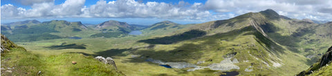
So now I was getting towards the end of 2019, I had pushed up the mileage of my local walks to getting to the edges of town, and out towards a big park the other side of town I decided it was time to start looking at going further afield for some better scenery and something more interesting. By this time it was getting into winter, the weather is not great and I wasn’t sure how capable I was going to be so thought it would be best to hold on until the spring before I braved a more ambitious walk. I had ideas of returning to North Wales. From many years ago a particular favourite area of mine and I thought it would be great to try a walk out that way, if possible maybe attempt a walk up Snowdon to really see if I could do it. See if I could prove I had come out of this medical period with a decent recovery and prove I could do it.
The plan was set, Spring 2020 I’ll plan to do a Snowdon walk. Then of course the world decided I wasn’t going to do that, it had other plans. The COVID-19 pandemic had arrived. That stopped everything, we entered into the first lockdown just at the point I was ready to get out to go further away and none of us could leave the local area, so for a much different reason I was confined to the local area again. Luckily due to the lockdown rules we were allowed out in the local area once a day for exercise, my first worry was if I can’t do that it would really set back my whole healthy plan. I didn’t want to take any break periods from the walking because I was thinking if I stopped for a while I might get used to not doing and would struggle to get back into it. An idea I stick to even now. Fortunately I could carry on with the daily working from home. My work continued to function in a slightly reduced capacity, the type of industry I am in (engineering) meant we were allowed to continue operating. We spent some time changing from our usual automotive parts to small components to help the medical industry. My job allowed me to able to work from home during the pandemic so my daily walk at work became my daily work at home during the lunch break.
This continued through various degrees throughout 2020, sometimes when restrictions were eased I was able to travel slightly further, within the county, to walk some parks and areas a bit different but I was getting to the point where my walking had improved, I was able to add a few more miles and I wanted something more interesting, some decent scenery and a bit more of a challenge. Into the second half of 2020 and getting towards the end of summer and into Autumn restrictions were eased even further, I was able to leave the county and do some walks further away. After a few of these I was able to start looking at Snowdon again. I found somewhere to stay, got it booked and made it there. It was a strange trip as there were still a lot of restriction rules in place, having to stay away from people and avoid contact. It certainly made the hotel experience very different.
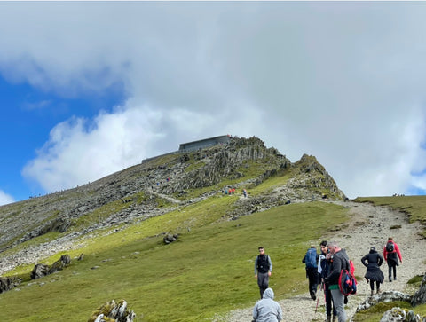
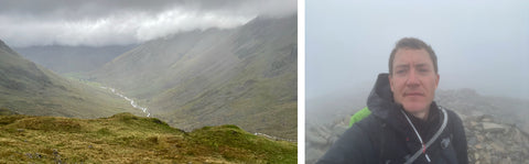
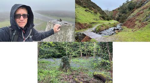
So finally, I started the Snowdon walk. Now at this point I haven’t started my “navigation” journey yet so this was just simply following the Llanberis path, some say the easiest route up to the Snowdon Summit. Ok it was my first proper challenge after starting my recovery and it certainly wasn’t easy, my right leg still isn’t as good as my left and I really have to think about where I am walking. It is difficult to describe but usually when you walk you just naturally get on with it without thinking. Because of where the stroke affected essentially I had to re-train a different part of my brain to walk. This means really having to think about it whenever I walk, watching where I am stepping and concentrating on the terrain. But with a lot of perseverance I managed to get to the Summit! For me and what I had been through, a massive achievement. We are now into October and the weather wasn’t great, it was a bit wet at the top and certainly cold and foggy but I got there.
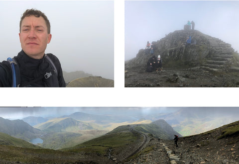
The coming down was actually a bit more tricky than going up, not as tiring but with my right leg issues I have to be more careful on the downs but I made it down ok and all was good.
After this I realised that I really enjoyed it, and wanted to do more of this type of walking. Winter was starting at this point so I didn’t want to risk starting out in the worse of the weather so decided to wait until Spring. Then once again we were back in lockdown so it was all stop, and once again I couldn’t go anywhere or get away. It was difficult to decide where to go, so after speaking to family, they had been members of a rambling group and had quite a few walking cards out of magazines so I had a look through those. I did consider joining a group but I’d been on a couple of walks with friends and family early 2021 while we were only allowed in small close groups in lockdown and I really struggled with those. Again because of what I had been through I found I really needed to be walking at my own pace. If I had to slow down, or speed up to match other people it tired me out a lot and caused quite a few more aches in muscles that just don’t respond in the same way any more. I know it doesn’t sound very sociable, and I apologise for that but I much preferred to walk on my own. It was best for my health and was when I was most comfortable.
A few more months of local walking during the lockdowns, and the not so good weather I finally managed to get out again around June time, 2021. This time up to the Peak District, not quite as far away as Wales so I could just about do it in a day. This was one of the walks from the cards. Finally, you will be pleased to read, this is the start of my navigation journey with my walking. My Welsh walk was easy from a navigation point. I used the standard path that most people use for Snowdon, it’s well marked and well laid out so didn’t really have to think too much about how to get to the summit and which way to go, I had a map and a compass with me in case anything happened but I didn’t need it. For my Peak District walk it was more unfamiliar, I was just using the card from the magazine to find the way. Again I had the map and compass, but just using the written directions from the card it was much more difficult. In places they were not clear, some of the paths and turns didn’t quite match and between that and my map I don’t think I followed it exactly as the route intended. I didn’t get lost as such because I am actually ok at just reading a map anyway and I found my way around it, but I had to stop often to get my bearings and work out the route so it wasn’t a smooth walk at all. At the end of this I knew I needed something much better than what I was using.
Firstly I am quite a tech person, with computers mobiles etc, my job usually means I have to be but I came into this knowing nothing about outdoor navigation technology. I started out looking at mobile apps. It was an obvious place to start as I always have my phone with me when I am out walking and I imagine it would be fairly easy to use that to find the way. First place to go, what have I already got, the in-built maps app? Great in the car, use it all the time. I looked at a couple of the walks I wanted to do, for the most part the places these walks went through were just big open spaces, no paths, landmarks, nothing. And setting a route only allowed a start and end point, so that one was useless. Next , what do I know about outdoor walking navigation? I use Ordnance survey maps a lot, I always took one with me, it was difficult to pin point my location but with an explorer map all the paths are there, the landmarks etc, I just need to know exactly where I am. A quick search on the OS website lead me to the OS app, perfect, full OS maps, on an app that shows location. I downloaded that one, subscribed to the service, and in the way I usually go about this type of thing taught myself as much as I could about the app, every method, function and setting. It seemed to be pretty good, I could plot out a route, I could even use it to find routes already set. There were some really good ones on there. I selected a few, modified them as I needed to and I was ready to go.
I thought I may as well go big to start, I already had done Snowdon but had got a taste for it and I’d only done the standard “easy” path. Last time the weather wasn’t great and not much of a view with the fog so I decided to tackle that again, but this time using one of the OS routes it used part of the Watkin path then diverted off to go to Yr Arran on some lesser known paths. I had my paper maps and I knew the area fairly ok so I booked a trip July 2021, hoping for better weather, to do Snowdonia again.
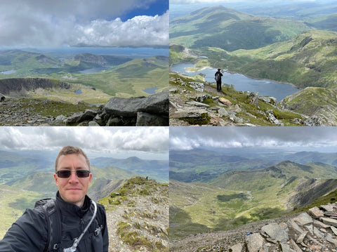
Originally I hadn’t planned to go to the summit of Snowdon, it was go up Watkin, then Yr Arran, back on Watkin further up then trace that back down. The morning of the walk I had woken up early and the weather was perfect, the sun was out, Sky was clear (ish) so I thought, change of plan, I need to do the summit to get the views. I loaded the route on my iPad in the hotel, looking at the route I could see it was possible to get to the summit from Yr Arran to Snowdon Summit on the South Ridge, the map showed there was a path, and using the 3d function in OS maps I could visualise it. I modified the route to include that part, it came out at around 9 miles which was longer than the walks I had been doing but I had all day so I went for it.
The first section was good, I found the divert point using the app, and followed the route as it showed. There were a few tricky parts, I was glad I had the full 1:25k maps on the app, the key part it showing the borders where the stone walls are and I could see which side I needed to be on. It was not clear on the land where the paths should be but the app worked well.
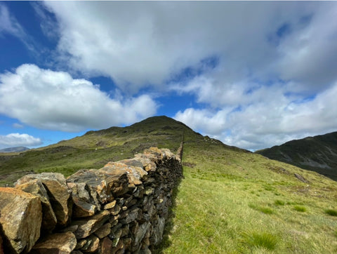
Nearer the top of Yr Arran it started to get steep. Now steep can be a struggle anyway but with a leg that now doesn’t work fully to 100% and an arm that still had issues, that affected my balance, the last section was really difficult, but I pushed on and got to the Yr Arran Summit.
Once I got there the sense of achievement then outweighed the struggle it was to get there. During the climb my mind was trying to tell me getting to Snowdon peak was going to be impossible and I may have to go back to the original route, but once I got to the top the extra adrenaline, and looking across being able to see the clear Snowdon summit gave that motivation to push on.
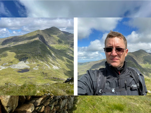
So I thought getting to Yr Arran summit was tough, for me that became insignificant compared to the South Ridge climb to Snowdon summit, It is difficult to describe how hard that was for me. Some of the path involved some hands and feet climbing up small faces, I had to be really careful here as it would be easy for me to slip but I pushed on. Occasionally I met some hikers coming down towards me, they certainly helped to motivate me to continue as I was able to briefly chat to them. In places it was sharp drops both sides, that made me quite concious of my balance issues, but as it turned out I was much better and getting through it that I would give myself credit for.
Nearer the summit the path joined with the more popular Rhyd Ddu route, then I started to see a lot more people as it got busier, I realised how quiet my path was by comparison.
Still I pushed on again and eventually, finally achieved it, I got to the Summit!…Well almost. Unfortunately We are July 2021. The UK is fairly open but there were a lot of restrictions on international travel so everyone was going on holiday in the UK. It was at that time that Snowdon was making a name for itself for being a very busy mountain. At the base of the summit I could see the extent of the problem. The massive queue to get to the summit.
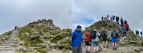
I was able to stand next to the queue for the top to get some pictures, Now, with my leg, walking is fine, if I keep moving I can go for quite a few miles, it would seem, but one of the big problems is I really struggle to stand in one spot. It really starts to ache a lot and I have to rest fairly soon. Long queues, even now, do scare me a bit as I can’t stand in them, but unfortunately I was alone, and it’s not possible to explain I can’t stand in a queue and trying to get a place marker is not practical. All these other people queuing no matter what is wrong with me are not going to let me in, as far as they can see I’ve made it this far, just queue like everyone else. I couldn’t then end up in pain as I’ve still got to get down so I had to sacrifice the actual summit. Still I had got to here, and I got the clear views I wanted so I decided this was enough and I’d done it.
The return journey was almost as hard, not as tiring but put a lot more strain on my legs. Some of the climb down sections were really tough, but I got down ok and all was good. I certainly felt it the day after as well! In summary though, the OS app had worked well, it put a strain on my phone battery and I did have to use a power bank to charge but luckily I had considered that and bought one with me. It seemed like it was the answer….not quite, on to the next challenge.
A few walks later, one of which was an easier one down in South Wales, a walk up Pen-Y-Fan, again the weather was ok, I found myself at the end of September with a few holiday days left to use I decided to go to the lake district. Got a late booking, planned a route on the OS map app, a combination of a couple of routes already there, packed up the kit and set off. The first day I got there the weather was ok, it was looking promising but I had my fingers crossed as I only had the following day, the one day, to do a walk I planned up Scafell Pike. The morning of the walk, one look out the window and it wasn’t as good, the clouds had appeared and it looked definitely grey. Once I’d put my kit in the car to set off and it started to drizzle. Not looking promising but I had the correct kit, waterproofs, warm clothes, good boots etc. I only had this one day so went for it anyway. Once I got to Wasdale Head where the start was the rain was coming down and the mountains did not look inviting at all. Still good chance to test the waterproofs, I tried to put a positive spin on it. I got the route loaded and set off.
This is where the problems started to come with my navigation method. The rain is coming down and I am trying to use my phone. Now it did have some waterproof protection so that was ok, it was operating it that was a nightmare. The touchscreen did not work well, I often had to take my gloves off to operate it, which then meant the inside of my gloves were getting wet putting wet hands in them, it was difficult to see and trying to clear the screen of rain meant catching buttons that moved the map, or trying to cancel the route, it made it all near impossible to use. That coupled with the difficult ground because it was wet, it was difficult to see where I was going, and some of the steep sections were really difficult. It was becoming more difficult than the long Snowdon climb. Once I got up around Sty head I was very wet, although luckily dry on the inside, my waterproofs were working well even though the phone wasn’t but this was the walk I came to closest to giving up and turning back as it was getting to much. I took a 10 minute break at Sty Head and somehow managed to convince myself to carry on. So I did, I pushed on, pushed through it, made a few wrong turns especially nearer the summit in the fog but eventually made it! I had got to the Summit of Scafell Pike. In that weather another massive achievement for me. Even with the struggles with the app, without it, in the fog, I would have never found the summit.
I had a shorter route planned for the down so at that point I was hoping it would get a bit easier, for tiredness it did but again, going down, is more of a struggle for me. I really have to concentrate on where I am putting my feet, especially on my right leg which is still struggling. At one point I did mis-step on a rock, slipped and fell over. I was ok as it wasn’t serious but I did put a hole in one leg of my waterproof trousers, at that point the bottom half of my left leg stopped being waterproof and got very wet all the way though to my skin. That made it even harder. There was also a difficult bit where there is a ford on the path, but in that weather it turned into to just a part wade, part step stones through a river. I did end up with slightly wet feet after that.
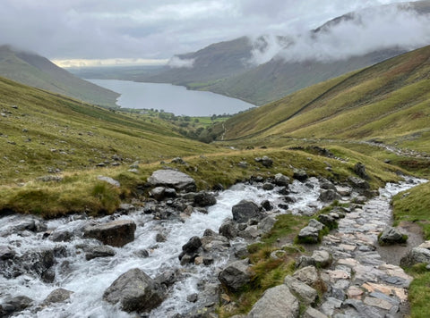
Eventually I made it back to the car. Another success, sort of.
My kit had held up reasonably well, waterproofs were good, apart from the hole, boots were good apart from the river dunking so I have my kit selection all sorted. Navigation, not so good. It is now obvious that using a mobile phone app is the wrong thing to be using. As well as the screen issues, the rain, the difficultly in operating it, at one point just off the summit I had to get the power back out and charge it for a while. In the rain, trying to protect the charger and the phone, and trying to navigate is incredibly difficult. So I needed something else.
Once home I started looking around. I had a rough idea what I needed. It must be Ordnance Survey maps, it must be waterproof, I must be able to operate it without taking my gloves off and it must have good battery life. Firstly OS themselves did a handheld device. Clearly the device would work as it’s OS, but they seemed to be out of stock on all the options with no indication when they would be back. A bit more research later and I learnt they had stopped making them, supplying them and supporting them, so that was out. I considered watch apps. I was already an Apple Watch user. I owned one even before I had the initial illness that started all this. Since the start I had been using it to track my health and record the workouts. To digress slightly the apple watch had been a great help from the beginning. Being a really tech person it was great to have some tech that was actually useful to get me through. I was surprising how good it was to get to the end of the day and get the daily rings closed. I still do it now. Without it, it would have been more difficult. The problem with a watch app was that although it would be great to have a map to follow on my wrist, the screen is very small and I’d need more detail, and battery on the watch was already a problem with a longer hike and using GPS and displaying a map would make it much worse. It would be better to leave that to just track and record the hike as I had been. Ideally I needed the handheld. A bit more internet research and I was starting to struggle a bit. It seemed there were not many companies out there that did that type of device. Most seemed to be pushing towards watches but I didn’t want that. Eventually I discovered Garmin. A brand I had certainly heard of before. A good look through the website revealed some ideal devices in terms of build, it ticked all the boxes, except it was very difficult to work out from their site what type of maps they had. The best option would be to actually see one of these devices, get my hands on it, try the functions, buttons etc and most importantly see what the maps were like.
It was winter 2021/22 at this point, it was difficult to get out walking with the weather so I was doing more local ones, I had left my research for a bit and thought I’d come back to it in the spring. Early 2022 I discovered there was an outdoor show at the NEC, Birmingham in March, perfect, sounds like the sort of show that would have demonstration models and devices. A quick look down the exhibitors and it showed that Ordnance Survey would be there, and a lot of other companies. I didn’t recognise most of them but I figured some of them must be doing outdoor GPS units. So I booked a ticket and went to the show.
I was very surprised to find there were no companies at the show that had any kind of GPS devices, there were a few doing outdoor clothing so picked up some new gear, but no GPS stalls, none at all. I had a chat with the guys on the Ordnance Survey stand, they confirmed they had stopped supplying their own handheld units in favour of their own app, that I was already using. I explained the issues but there wasn’t much else they could offer. They did say they supplied digital maps to GPS companies but couldn’t say which ones, or recommend anything. I mentioned they should make the app work on the apple watch as well, if they could display their map on there it would help. Unfortunately since then they did app a companion watch app but it doesn’t show the route or map, just a way to stop and start recording. Handy but not what I wanted. I came away from the show not finding what I wanted. Later they sent me a feedback form, it appeared it was a new show and they were finding ways of making it better so of course I commented they needed some GPS companies.
With that failing I needed to find a store, in my local area, the Midlands, there are not that many outdoor shops about, we have the usual chain ones so I visited a few of those looking for demo models of GPS units to get my hands on. None of these stores had any kind of display models, nothing I could see, and I couldn’t seem to get much information from the staff either. A couple did online orders but I needed to see them first. They couldn’t offer that. A couple of the shops did have models of watches, but behind glass cases and they wouldn’t allow me to test them in the store. They didn’t say but I guess they were just shells and not real working models. So not very helpful. Starting to get a bit stuck now. The ones online are expensive and I didn’t want to risk ordering them and have all the problems sending it back if it’s not suitable.
Again I left my research for a while, spring time now so I could get out for some better walks. Not too bad weather wise but a few wet ones reminding me of the difficulties with the app but still struggling to find what I want.
Into may 2022 and still no GPS unit, with the weather getting better I needed to get back out to the mountains again. North Wales was still my favourite area so I booked another Welsh trip. I was familiar with the area now and it didn’t take much planning. Now, I am going to a heavy walking area, there must be some stores around there that stock and can show GPS units. I purposely travelled through Betws-y-coed on the way as that had a reputation for outdoor shops, walking gear etc, should have been ideal. Stopping there I spent a couple of hours going into every shop, and not one of them had any GPS devices for sale, or show. A couple of them advised online shops but no one could tell me what I needed to know. This was starting to get difficult now and it’s looking like I might have to take a risk on it, but it’s a lot of money and it needed to be right.
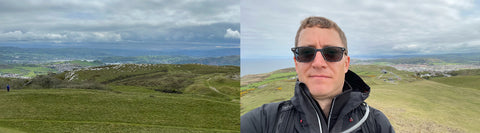
Anyway I did manage to find a good walk on the Great Orme, Llandudno, a fairly simple navigation one and the weather was ok, so my OS app is still working ok, even though I am having to charge the phone a bit on route.
Then the day after, with the weather still reasonable I was able to do Snowdon again, there are still plenty of paths to do so I went for the full Rhyd Ddu path up and the ranger down. It’s mostly a defined path so didn’t need to concentrate too much on the map. It was starting to look cloudy at the top, but it cleared enough to get views. There were a few worrying parts of the path with the drops on that one but I was managing my not so good leg and my confidence was better so this one was easier to just get on with.
Another great walking trip but still no luck on the GPS. We have now got to July, the weather is much better, perhaps I could try the lake district again, surely this time I could get a view from Scafell Pike. I’d done the walk before in terrible conditions so this time I thought it would be easier, weather will be better and I knew where I was going. It was looking promising so got it booked and went. The lakes must have some good Outdoor stores where I could actually get my hands on a GPS to try as well.
The day before the walk it was looking ok for the following day so still all good. Then on waking that morning, I looked out of the hotel window, and against all weather predictions, the clouds and rolled in and it could only be described as grey outside. It appears the lakes were not going to be kind again. I drove to the starting point and the rain began to fall. Again I had the correct gear and I was there, I only really had that day to do it so I pressed on. The entire way up to Scafell Pike the rain did not let up, with a very tough walk, although now I knew the way mostly, I made it to the summit, and no surprises, no views from the top again. The weather reminded me of the difficulties I had trying to operate the navigation on a mobile phone screen, in those conditions, even in summer it is almost unworkable.

The last day of this trip I was able to visit Ambleside and Windermere, surely a great place to find outdoor stores and GPS devices, but again, nothing, not one store in any of those places could offer anything at all in the way of units, or advice on them. This was starting to look like in the UK these things were just not about with good UK mapping on, I am starting to think that no one uses them at all and they are just not available unless I go online and risk it.
I did a bit more searching to see if I could find any reviews or user experiences online, there were a few on there but peoples opinions are always different and its difficult to get a clear picture from this. I came across the Garmin site again, this looked promising but the site, even though the UK version, seemed still very American in its information. I liked the devices but it still wasn’t clear on the mapping. I still wasn’t quite brave enough for a risk on committing that amount of money for something I didn’t know enough about.
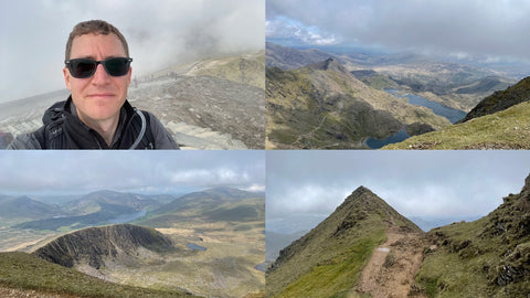
Away from this I started looking for my next walking trip. So I’ve done Snowdon and Scafell Pike this year, surely I should look at completing the set so I turned to looking at Scotland and a Ben Nevis climb. This one I knew nothing about. I had never been to that area other than driving through it quickly on a driving event we did a number of years ago. I knew nothing about the walking, routes, places to stay, anything. I started with finding the information for the walk itself. As it turned out the actual walk is pretty clear, a defined path all the way up. As far as I could see there was only one major route, others that came up were all stressed for experienced walkers with difficult terrain and navigation challenges. I still haven’t sorted my GPS yet and with my condition still ongoing, and this being an unknown I didn’t want to risk it so the standard path is the answer. Fort William was the place I needed to be for the start of it so found a place to stay got it booked up and I was all set.
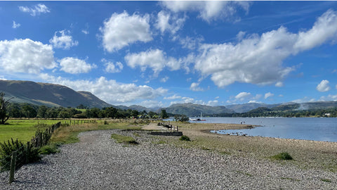
Fort William, and Scotland itself is a long way from where I am in the East Midlands and its a long time in the car. I am not supposed to spend that long just sat in one spot because of my medical issues, I need to move around every couple of hours so I planned a stop on the route. Of course I can stop at services and walk about but to make the journey more interesting, and I was driving right past, I stopped off in the Lake District and did a walk around Ullswater. A great shorter walk and the weather was good so it was a good place to stop. It broke the journey up nicely.
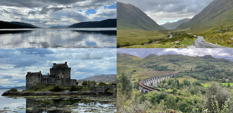
Back in the car and continue the drive into Scotland and on to Fort William. It is certainly a long way but once I entered the scenic areas of Glencoe it was worth every minute of the rest of the drive. An amazing looking place, even more dramatic than I was used to when travelling to North Wales.
I had a hotel in Fort William, a really nice town on the edge of a loch, a good location for the starting point, and on waking up on my first full day there the weather was good enough so decided to go for it that day. Set off for the starting point at the foot of Ben Nevis and got going. The scenery around that area is absolutely stunning, it was getting close to becoming my new favourite area. This gave me a great boost to get this walk done, and distracted from the fact that this one is a lot higher, harder and longer than the ones I had done before. This walk was also a simple follow the path to the summit then take the same path back down. So if it was too much or I got into difficulty I can come back down the same way and not be stuck. Luckily I didn’t need this option.
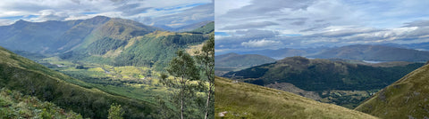
Getting nearer the summit the clouds did start to come in a bit but for most of the way up the views were amazing.
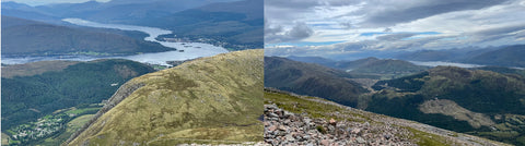
Eventually after a long climb I made it to the summit. Unfortunately the summit was fully in the clouds so no views there, but I had made it, got to the top, the highest point on our small island.
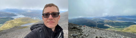
This one was certainly a tough climb, although actually not a difficult as I was expecting. Tough as in it seemed to just be up all the way, previous mountain walks usually have some points where you get a bit of a break as it flattens out in places before the next up, this one seemed to be up all the way. Not as difficult as in the path was clear all the way, there were no actual climbing sections, it was just straight forward walking all the way and navigation was simple, I had my OS app running for this and of course a paper map and compass for emergencies but I didn’t really need either, the direction to travel was obvious most of the way.
The return route revealed more stunning views, spectacular scenery all the way. The coming down was tough in a way, again due to my issues the downhill puts a lot on my weaker leg, and at one point I did get a bit carried away with it and was probably going a bit too fast and I did have a small slip and fall. I was ok and with a bit of first aid plasters on my hand with a small cut and slightly bruised leg I was good to carry on. It gave me the reminder that I need to be careful and concentrate all the way, even when the walk gets a bit easier.
Just about made it to the bottom and back to the car park with no more damage to myself. I then fully realised the achievement. This year, 2022 I had managed to do all three of the British Island Mainland mountains in the one year. Ok it wasn’t the 3 peaks in 24hrs or whatever the challenge was but after everything I had been through a few years ago I never thought I could get to this position and be strong enough to do the 3 peaks, as far as I was concerned I’d done my own version of the 3 peaks and I had done it!
Anyway, after that victory I still had the rest of my trip to Scotland to enjoy. Back on the GPS mission I did think that Fort William, with all its walking locations, must have some decent outdoor shops. A shopping trip to the centre revealed that there weren’t that many. Some did do clothing and equipment and I did manage to pick up some gear but once again I was out of luck on the GPS mission, I was really starting to get a bit stuck with this one, shops just don’t have them, or any information about them.
Still, the rest of my Scottish trip was great, fantastic scenery, great places to visit, and for the most part the weather was kind to me.
Now on the run up to the end of the year, 2022, managed to fit in quite a few more decent walks, local ones and a trip to the Peak District, that one didn’t go as well, not because of the walking and not a story for here, and one in the Malvern Hills. Still no GPS device.
Beginning of 2023, while the weather is still not great to get out for decent walks with views but still doing local ones and I received an invite to the NEC Outdoor show again. I had a look though the information and the companies attending and on that list was a company called GPS Training (yes, we have finally got there!) I hadn’t heard of the company before, surprisingly enough it had not come up in any of my previous searches for GPS equipment. I had a good look though your website and it looked perfect, a British company with the types of devices I was looking for. To get a chance to see one I booked a ticket to the show.
At the show and after having a good look round at the other stands I arrived at the GPS Training stand, and there they were, all the devices I had been looking at, all laid out and powered on and ready for testing, perfect.
There were a lot of people with a lot of interest in the devices so I waited my turn and I was then able to talk to an incredibly helpful and friendly lady about my requirements, what I had been looking for and what I needed. She talked me through some options then showed me a couple of devices, my interest was taken by the GPSMAP 67 by Garmin, I don’t remember seeing this one previously in my searches but she pointed out it was fairly new out.
I was able to have a good look at it, and the thing I had needed to do for a long time which was actually have a go. I could see it had the Ordnance Survey mapping on it, the maps I was used to and the ones I wanted, ok it was an extra option and added a fair chunk to the price but it still seemed like what I wanted. I spent some time there asking questions and trying out functions all the while she helped me all the way. Unfortunately I did not ask her name as I would like to thank her by name but I didn’t think at the time. So I had learnt enough and had pretty much decided this was the perfect device for me but for some reason something held me back from buying it there and then. I think with tech I always find it difficult to just jump straight in, I needed a bit more time to think about it, maybe because it was a lot of money.
I had a bit more of a look around the show, I think I probably came back around the GPS Training stand a couple more times trying to convince myself it was the right thing to do but the stand was very busy so I left it for this event.
By the time I got home I had convinced myself, I then regretted slightly not buying it at the time so the following day, on the strength of what I learnt and the help I received I ordered the device with the 1:25k OS map card, and looking at the accessories the backpack tether also looked like a great idea so I ordered that as well.
Delivery was impressively quick, only a day or two and then a few days later I received an e-mail from GPS training asking for some feedback. Now experience shows that most places I have ever left feedback have never resulted in anything, but I thought I need to leave something.
From this moment onwards my opinion of GPS Training went to a new level.
I received a phone call from yourself at GPS Training to talk about the feedback. This has never happened before with any company and it turned out to be a really good call. It showed your company to be real people, actually care about customers and the products you sell. We had a good chat, you then also introduced me to the online content and material you have, and you also sent me out the correct Mac version of the Basecamp software.
It is difficult to explain how good and welcomed that call was.
So now I have my device set up, enough understanding to get going, got basecamp sorted and I was off and running.
Soon I was ready for my first trip with it. I had a planned trip to Yorkshire, a couple of days in the dales and a couple of days in the moors. Perfect for a first try with the new device. I planned the routes out, partly in my original OS maps app as I could pull from some preset routes for the area, and partly refined in basecamp. Then transferred to the device ready to go.
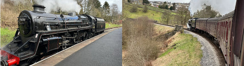
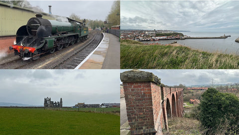
First stop was a smaller walk from Oakworth, partly so I could take a trip on the Keighley and Worth Valley Railway. I had my route set into the GPS as a track, I think it was the default method when transferring from OS maps to basecamp. At this point I hadn’t tried to record the route yet but I followed the route as a track on my device and worked out really well, ok, not a difficult walk, an easy route to follow but it was clear that the device was going to work well. Being March in Yorkshire, it was fairly cold, one of the big requirements was being able to operate the device with gloves on, and yes this problem was certainly solved. I didn’t have to take them off once to use it. Walk one very successful.
Onto the next walk in this area, Out of Malham including Malham cove and Malham Tarn. For this the weather was perfect and the views ideal. I started to experiment with the device a bit more, I started a recoding on this one, but I did have a few issues with that, something happened about a quarter of the way round and it stopped recording. I have since found that the device doesn’t seem to like having the screen off and using the key lock. When unlocking and activating the screen it sometimes freezes and resets. I got round this by either setting the screen to always on, or not locking the screen. With the screen off the first press just turns it on with no function activated so not much of a problem. I have since found I prefer to keep the screen on anyway as it’s better for quick glances. Onto the other massive advantage to the device, battery life. Even with running the screen on (backlight off) for the entire walk the battery lasted the full trip, at least 5 walks on the trip without needing a charge. Very different to charging my phone part way round the first walk.
As for the navigation, ideal! The route was easy to follow on the device when I didn't know the route. Due to weather earlier in the week part of my chosen path was blocked with water and debris but with the 1:25k map card I could use the on screen map to work out a route around the problem and re-join my planned route further round, really easy to do by just using the map. I turned out to be a very enjoyable walk. The other item of note with I found very useful was the Garmin backpack tether, glad I bought that as well to have the device within easy reach on my rucksack strap. Ok, it would be better they designed the tether cord to come out the bottom rather than the side so it doesn’t catch the Velcro but still, it worked well. Although I have since had to get a replacement as the velcro attach method hasn’t lasted. That would be better if it was a spring loaded, quick release plastic clip instead. Anything with velcro fastening never lasts. Most jackets and clothes go the same way although it is more important the velcro holds here. Anyway, all part of learning the device and kit.
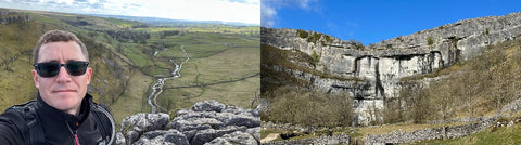
Great views from the top but coming down the side of Malham cove reminded me that I still need to be more careful that most walkers as the down is difficult on my leg that I still have to concentrate on the movement. Much improved since the beginning of all this but it will always be there as a reminder of what I went though, and what started me on this journey in the first place.
Apart from the slight mishap with the recording at the beginning the navigation on my GPSMAP 67 was excellent.
Next, on the the second part of my trip, I moved on to the Yorkshire Moors, with a stop at York and a walk around the city, in the rain, but it was still a good walk around the city walls.
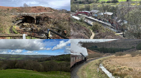
Onto the moors themselves, I had again combined my first walk with a trip on the North York Moors railway. I was already based in Pickering so a quick walk to the station, and then the full length of the railway to Whitby. Another great walk along the cliffs at Whitby and back along part of the cinder track across the Larpool Viaduct. Not much drama on this one, fairly easy route to follow and easy navigation. Really starting to get to grips with the navigation.
On the second day of the Moors trip I was able to take another rail trip, Due to a ticket deal they were offering, the second day was a free trip, so another day I didn’t have to get the car out again.
This time I stopped at Goathland for a walk into the moors and between the Goathland and Grosmont stations. This time instead of just using the map view on the device I used the compass view with pointer, this one showed me more information about the route, being able to set data fields as per my choice is a great feature. I can then include Estimated arrival time, handy for needing to be back for a train time, distance to go and distance walked.
However I did find a bit of an issue here, so far I have only been navigating with a track, the default method of transferring routes, more on this later. On some parts of the route the footpath wasn’t quite aligned with the route I set, at points where I was slightly off the path the compass tried to point 180 deg behind me, like it was always trying to get me back to the point I had missed, rather than directing me to the track. It seemed very fussy. I found I had to refer back to the map page often to check my direction and I was still on the correct path. It also doesn’t give any notification of direction changes which meant I was looking at the device a lot.
There was one part where I missed a turn though, and part way down the wrong path it did alert me to tell me I was off course, so that was good.
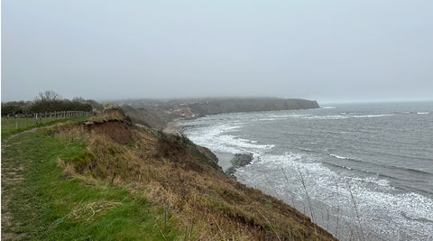
The last day of the trip, and the day I was due to go home I had some time so decided to go back to the coast first and do a walk from Robin Hoods bay. This one I hadn’t preset so using my iPad in my hotel room I was able to find a route in my OS maps, tidy it up a bit, then transfer it to the Garmin Explore app, then transfer it to my device, all while away from my computer. That worked really well and another impressive feature. As it turned up the weather turned and it came out quite wet, still once again it proved the devices worth while being still easy to see, and operate in the pouring rain, still showing it was the perfect device. Also worth a mention that for the entire trip I didn’t have to charge the Garmin once, the battery life is incredible and enough to do a few days walking with no charging required.
Once back home I had some more time to dig into research on the device. I had the online resource that you had pointed out to me so I started reading up a bit more. Turned out to be an incredibly useful place for information. Not so much on the use of the device itself, that much I could figure out, but all the other things that it’s possible to do with it. You don’t know what you don’t know and this really helped to fill in the gaps. I started to learn a lot more about the different navigation methods, tracks wasn’t the only choice, it seemed that routes suited the type of walking I was doing.
I carried out a number of test walks at home, I found routes was certainly a better way to navigate, the audible alert at the turn point was a good feature, this didn’t exist with tracks, although with routes if I did happen to miss a turn I didn’t get the “off course” notification like I do with tracks, but with the alerts it is much less likely. More importantly the routes seemed more forgiving. Occasionally, when the actual footpath doesn’t quite line up with the mapped route then I found the track method was always trying to get me back to the previous point until I hit the next one, so when navigating on the compass screen it was often 180 degrees out trying to get me back to the last point so I often had to switch to the map where I could see I was going in the right direction when the compass was wrong. In routes in the same situation if a point was missed then it would correct itself and try to get me to the next closest point, so while being slightly off the route the compass points in the correct direction to get me to the next one. I do prefer to navigate on the compass where I can as its very clear and I can set four data fields for useful information. On the map screen, although the data fields are available there it takes up a lot of screen space where you need it for the map so clearer to turn them off when in map mode. I also found the trip computer to be more useful for extra data fields anyway. It’s easy to page between the screens while navigating. I have set up my pages to be just the ones I need. Again, when the weather is bad it is still easy to operate the device, with gloves on. It stops all the problems of wet gloves inside, and trying to work a touch screen in the rain. Good to know the device is waterproof and protected from these elements. The tough design gave me confidence to know it will perform well even when the terrain is rough and I risk dropping it, always a worry when I was using my phone. The screen on the Garmin did worry me a bit though so I bought a hardened tough screen protector for that, I would recommend that to anyone, it doesn’t matter if it’s thicker than a phone one as long as it’s clear, no touch screen means it doesn’t have to work though it and I like the extra protection. I didn’t want to add more bulk by putting the Garmin in a case and it’s tough enough without. Added to that the backpack tether means I can’t completely drop it anyway.
On to more of the planning stage. I am using the basecamp software as recommended by yourselves from Garmin’s website. This is an excellent tool for managing my routes and planning them out. The features this has like splitting, joining and reversing routes makes this fairly stand out to anything I have used before. I can see why some people could be put off by it as it is a bit more complex than some of the web based tools but this is needed if really wanting to plan proper routes and manage the ones I have. I do still use my Ordnance survey app as well to find pre-existing routes, a good source for that, and to occasionally plan out a route while out and about like I did in Yorkshire for my final walk as it works on an iPad from a hotel. I have tried to use Garmin Explore to actually plan a route but this only has the topoactive maps which are not great for the UK and Explore is missing a lot of the useful tools OS maps has. It seems this software is fairly new and needs a lot of work to make it useful. All I use it for is transferring routes to the device when out and about away from my computer. It seems that Garmin are now trying to retire Basecamp by not putting any more development into it and hiding it away on their own website, these days it takes some finding so I have stored away the install in case they do remove it. I hope their plan is not to just use Explore as it’s just not suitable yet and with no access to Ordnance Survey maps on it fairly useless for UK route planning. Basecamp itself does seem to need more work as it has it’s issues that I can work around. I guess it was originally designed for Windows and has been ported over to Mac. It is for Intel Macs still so Rosetta is still needed to run it but it works ok. I have found it’s not possible to access the internal memory of the Garmin as a drive on the Mac, it only works through Basecamp. There is software available for this but as yet I haven’t needed it as Basecamp is doing what I need. Basecamp is a bit slow and takes a bit of work to display the full map from the device by turning the detail up and down and move the map around and eventually it loads, it often gets “stuck” with panels of the map missing but I can get it there. I have found the map image is not as clear as it is with the Ordnance Survey app so occasionally if I need a finer detail I refer to the app. I guess that is the resolution that OS allow Garmin to have on the map card. I hope future cards have higher resolution.
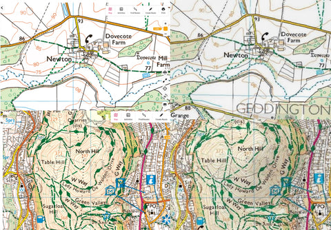
Actually not that clear on here but you can see the difference, especially in busy path areas. Anyway it’s good enough for use.
I am also struggling with Elevation graphs. Any route I create just shows a flat graph.
If I convert the route to a track then it displays fine.
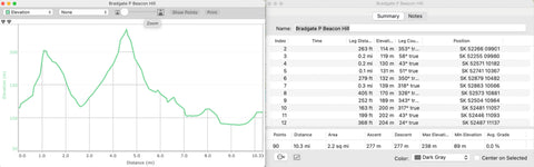
So my workaround is ok for now, apart from that it is the best software for full editing of routes and getting them to do exactly what I want.
Note below - solution to the problem above (from Kevin himself)
--- start ---
I have the MacBook Pro with 3 USB-C ports and I use a USB-C to USB-C lead to connect.
On first connection for a new clean install the graphs work fine. If I then connect the device to a different port next time I use it, basecamp runs much slower, maps do not load very well and the elevation graphs are flat. Trying to return to the original port gives the same problem.
To solve this I performed the following:
So with a few more local walks, ones I was already familiar with I could do a lot more experimenting with routes. I certainly confirmed that using routes to navigate is a lot better than tracks, particularly for unfamiliar routes. I learnt to be more conservative with the amount of points I was creating. Slightly cutting corners etc did reduce the accuracy of the total distance, but I am using OS maps for that, it was better to not have so many turn alerts. I found if I had too many I started to ignore them and missed a couple of important turns. I found the least amount of points I could get away with while still being accurate enough to guide the route is best.
Onto the next away trip. This one I had planned for the new forest as I had an event I needed to attend down there. I combined this with getting some walking in as well. During my routing research using your online resource, experimenting and web research I found the turn by turn routing method in the National Parks on the 1:25k OS map. I was keen to try this method so first I found a couple of routes in OS maps, instead of just importing these to Basecamp, I changed the route planning method from Direct to Hiking and planned the route into Basecamp myself but only needing very few points as it was following the footpaths already there. I creating a full 7-8 mile route with only about 5 or 6 points on the map, the hiking route did the rest.
Transferring this to the GPSMAP 67 itself I then swapped the profile to the Hike NP for National parks, had a look at the route, looked like it had picked it up so I was good to go.
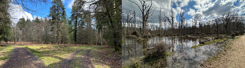
Arriving at the car park in the New Forest, I set my route in and started the recoding and I was off, now I am getting real directions at the turns and more information on the map screen to show where to go, and where the turns are, a different experience but pretty good. It was early April and had been wet through the winter, so at one point the path I wanted to use was flooded and blocked so I needed to divert around it, I found a different path just using the map screen and as soon as I started to follow that the route it automatically updated to get me to the next point and gave me good turn by turn directions. All round another impressive experience and the device worked flawlessly, It was even more impressive that with the very heavy tree coverage the GPS signal was still very accurate. My Phone app would have drifted here and only given approximate positioning for a lot of it, the Garmin GPS was spot on accurate all the way. Another successful walk, well apart from the very muddy and wet boots, but given the weather and the location I did expect that. As far as the scenery goes the New Forest was good, and different to where I had been before but if I think about it I’d prefer to be up in the hills or mountains. Some of the trails were a challenge to follow here through the trees but with my medical issues I like to push a bit, the hills do that but I didn’t think I was pushing myself enough here, and I was missing the views.
The second day I attended the event I was here for, a car show at Beaulieu. I hadn’t planned a walk for that day as I didn’t know what time I would have but I did have the Garmin with me. With some time in the afternoon I was able to do a walk down to Bucklers Hard using a footpath route down to it. With nothing pre-planned I was able to use the National Park format of routing to just pick a point straight on the device at the destination and follow that. Considering I hadn’t planned that it worked really well and guided me as well as a route I would have planned out. It is a shame this function doesn’t work everywhere but with the UK footpaths and the complexity of them I imagine this would be an impossible task to do. I don’t live that close to any National Parks so unfortunately I will not be able to use this functionality very often. Still, point to point direct routes are ideal for what I need everywhere else as long as I have planned well.
Back home now, a few more local walks later and a lot more experimenting with the device. I think I have pretty much got my routing methods perfected now. Certainly routes seem to be the best way to do it, but making sure not to overdo the points too much. The other option is also courses. I am not entirely sure how they fit in to the system and what they would be used for. I have tried using the course method a couple of times. The display is a bit neater as it doesn’t show all the waypoints on the overview so it’s easier to see, but when navigating the alert at each waypoint is different. Instead of just a tone it shows a popup at each point that needs to be cleared. Unless I go through the route and name every single point it is just a sequential number, If it’s not cleared it is just in the way on the screen for a minute or two until it clears itself. That is not as good and not as useful. However the active route display is better as it does give approximate distances to the waypoints. The route method just shows the list of points with no information.
For the actual navigation experience I still prefer the route method anyway. I have found that if I was to plan out a route on Garmin Explore directly, course is the only option. I can however convert to a route on the device. It’s unlikely I’ll plan this way though as it’s only Topoactive maps on there, no OS maps access so not very good for planning. I’ll stick to Basecamp, or the OS maps app and transfer with either of those.
I do like the estimated time of arrival feature that updates during the walk. I have found with this that often I need to know what time I am arriving at my set lunch stop, rather than the end, although I need to know the end as well. The way I found to do this is to break the route up at the stop point and have them as two routes, well, actually three as I keep the original as well. I can navigate the first section then I get the ETA at the stop. If I need to see the ETA for the total I can simply swap the route to the full one, then swap back. After the stop I can then use the second section route. This one automatically is at the top of the list, being the closest point.
I have also found that the proximity alerts on waypoints is a great feature as well, if there is something I need to look out for on a route, significant way point, or feature I wanted to check I can add the individual waypoints, independent of the route and get a route when I am close to them. Then I remember to check out the feature.
I have probably gone on enough about the device now, I am sure there is much more I can say or comment on but I am sure you know all this already, just wanted to talk about my experiences a bit.
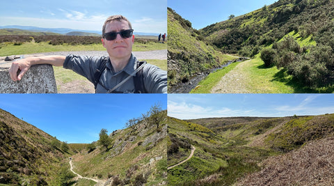
The device got another good test on a walk in the Shropshire Hills and across Long Mynd. An area I had not been to before so the navigation was very much needed. It was also very wet so once again a good wet weather test with gloves on, and once again the device performed flawlessly. This time using the point to point route method of navigation with the alerts at the turns, but I am starting to get this exactly as I want it with no too many alerts, enough to follow the route and give a rough guide on distance and tell me when to turn.
Some more local walks done, and a month later I wanted to go back and repeat the Shropshire Hills walk, as the weather was so bad and it was foggy at the top, so no views. This time a nice day so a last minute decision to go back one morning. The route was already loaded as I knew I wanted to repeat it so I was ready to go. This time I did get the views I wanted from the top and the sun shone for the whole walk.
Starting to build up a bit of a library of good walks now, another thing that Garmin Basecamp is very good at, where Garmin Explore is not so easy to organise them. With Basecamp I can have lists that include routes and waypoints grouped together, then folders so I can group the areas together, Explore just has the collections, which is ok in a way but it would be much better if they included another level, maybe collection groups perhaps, so I can put routes and waypoints in a collection then group those by area.
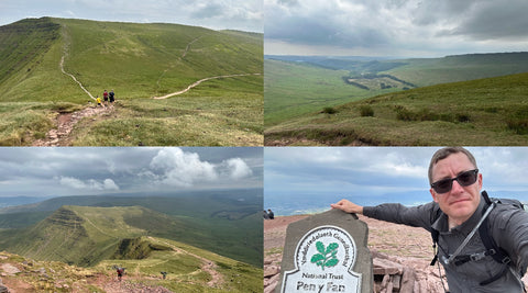
Into June now and in need of another trip away I planned some routes in South Wales, into the Brecon Beacons, (or whatever they are called now, I can’t pronounce it, or spell it) A bit last minute but using basecamp, and the National Park method I was able to lay out some good routes to get me to the summit of Pen Y Fan. I borrowed some parts of some preset routes from the OS app again, transferred them to the Garmin and I was off and away. Once again another successful trip with the GPSMAP performing perfectly all the way through. With this equipment it further fuels my want to get out on these walks. With the pay off of the views as well and with everything I had been through a few years earlier these types of walks always do wonders for my mind and it is keeping me fit. Probably the most important part of it. Ok, it is a few years on but the memories of the hospital treatments and not being able to walk much at all for a few months there is no way I am going back to that.
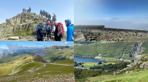
I was really getting the hang of the GPS and pretty much knew all the ins and outs of it so the year continued with more trips away where possible, including Shropshire again, back to Yorkshire, and as is now starting to become a bit of a tradition, another trip to North Wales. This was part of a family. During this I was able to plan a hike up Snowdon again but this time using another route, up on the Ranger Path, down on the Llanberis. My niece decided she also wanted to experience this one as well so she joined me. We had done some earlier practice walks locally and a couple of smaller day ones so I was aware she could do it but it was strange to have someone with me. I did enjoy the company and showing her the scenery of what is probably still my favourite area, but it was very difficult walking with someone else and trying to keep the pace. I found I certainly wasn’t as smooth on this one, proved by aching a lot more than usual when we finished it, particularly on my worse leg. She made it ok through the walk though so I was proud of her for that one. It made me remember how difficult it is to walk with someone. If it was an unfamiliar one it would have been more of a struggle. That sounds a little selfish and I don’t mean to be but it is what it is. I hope she can join me on some others, maybe easier ones on me but I’ll have to keep the hard ones t myself for now. I even braved the queue at the summit so she could make it to the very top. It was also the first time I’d seen the Snowdon Summit above the clouds rather than just in them.
It was around this time that I also discovered the Podcast by GPS training. I had listened to a few other podcasts before, but not many. On a lot of my local walks, at least my daily walk where it is mostly the same, I had been listening to a lot of audiobooks. A great way to catch up on books I hadn’t read while still exercising and walking. I listened to the latest GPS Training Podcast at that time and it was surprisingly good. Some really good information with Andy’s tips, and information about new products. I picked up a few things I hadn’t thought about before, and some of them I adapted a bit from things I knew. I also liked it sounded like it was presented by a couple of normal guys who also enjoyed going out for a hike, and talking about the tech to go with it. I went back a bit and also listened to the one featuring the GPSMAP 67 so I could learn your own opinions about it. Again, more interesting information. So with some more local walks I decided to go right back to the beginning of the Podcast and listen to them all from the start, back to 2017 I think it was. I was good to hear how the technology had changed over the time, and the different styles of the Podcasts, through the era of Andy’s time away and Ian co-hosting, his FAQs were also very good, it did highlight that quite a few GPS users need a lot of help when using these devices. The tale of the rise and fall of SatNav was also interesting and it is also good that you support these other companies with the now introduction of TwoNav, although I think I have found my perfect device in the Garmin GPSMAP 67. I especially liked the features with other walkers on there and other organisations. Some of the charity and long distance walkers were very impressive but it dd make me think that my walks sounded a lot more simple by comparison, and a lot of what I have spoken about here is certainly no where near as impressive as what some of those walkers have done and been though. But as I said at the top of this, these stories inspired me to write this in the first place.
So coming to the end of the 2023 walking season, I wasn’t able to do a big walking trip in the Summer as we had a different trip that we did, a pretty big road trip across the USA doing Route 66. Not really suitable for this story but took a big chunk of time. It worried me a bit with a lot of time in a car and not looking after my health as much so I tried to combat that by walking every early morning before we set off and into the evening when we arrived at the hotel for that night. It was a great trip and I did actually find some areas I’d like to return to so I could try some routes in America. One to think about for next year.
I did manage to get in a few winter walks again at the end of 2023 into 2024. This winter seemed to be particularly wet and it is proving very difficult to find walks where I don’t end up with very muddy boots and having to spend a lot of time cleaning them.
I did have an interesting encounter when out walking at the beginning of this year, 2024. Through listening to the podcast, being a more technical minded person I was wondering who these people are you talk about on there who need as much training and really don’t understand how these units work, but recently I actually met someone in that position. I was walking in the Malvern Hills using my GPS to navigate when someone coming the other way spotted I was using it. He greeted me then asked me about it, particularly how I was getting on, as he had also bought one some time ago but was really struggling with it. It turns out he was only using it as a digital display of a map. Previously he had been using a traditional map and compass. He had never transferred a route or any type of guidance on to it so had never had anything to follow. He didn’t know it was even possible to use it that way. He had no awareness of Garmin Basecamp, or other online software. He has a computer at home but he explained he lived in a remote village and had no internet access. I demonstrated how I was using mine and he was quite surprised. I then suggested he should get in touch with yourselves to get much more information and consider a training course. Turns out he did buy the unit from you, but as he didn’t really understand the paperwork he had with it so had ignored it completely. I think I had opened his eyes to it a lot more, and maybe by seeing it in action and how it can work. I strongly, again, recommended he should go through the info and get in touch with you, so hopefully that will help to raise your profile further and there is a good chance he has been in touch.
For this year, and with inspiration from the Podcast stories I need to try to push my walking up a level. I have tried to push my walking distances up to the 12-14 mile mark away from the 8-9s I had been previously doing. Still not in the league of the podcast stories, in particular the Spine Challenge that some of your members have taken part in. It sounds like a fantastic event but incredibly hard, I am not sure I could manage that one, to be fair with my issues, ok, probably as good as I am going to be, but a challenge like that probably wouldn’t be safe for me. However I have started to look at the trips on your parent company, Shepard’s Walks, some of the multi-day events sound really appealing as it solves some of the issues I would have. I can’t carry much weight so having my luggage transferred helps, and for me I can’t really do camping as I need to make sure I sleep properly, and comfortable, so a nightly hotel is the only answer. Hopefully this is something I can do later this year on one of the self guided ones.
This brings me right up to date and brings me to the end of this tale, but most definitely not the end of the story, hopefully that is a long way off yet. I have ended up writing a lot more than I was expecting on this, I hope some of it has been interesting even if I’ve gone on too much!
iancb59@gmail.com
Really inspirational story Kevin. We’ll done in achieving all of this, you’ve obviously got real determination.
I completely agree with your advice on going for 1:25000 card. I went for 1:50000 and have never fully got to grip with navigation on my 66S, expensive mistake.
Good luck for you future expeditions 👍🏻