
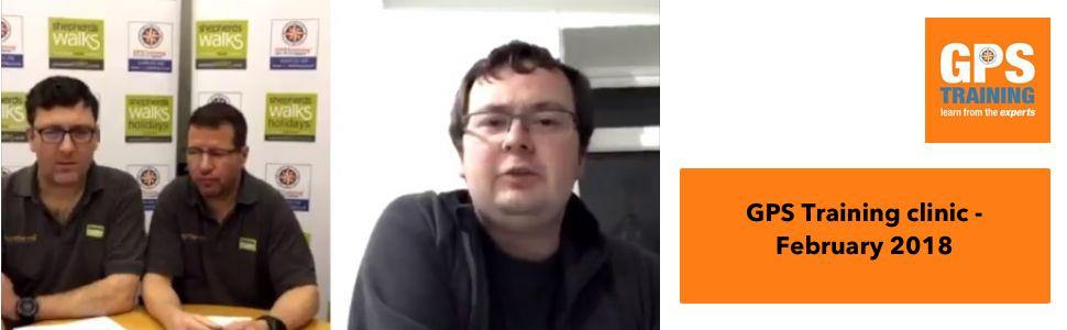

GPS Training clinic - February 2018
Watch or read the transcript from this week's GPS Training clinic - February 2018
During this recording, the team answered a number of GPS questions that had either been e-mailed in or asked live during the live streaming.
Jon: Alright, okay Andy, thank you very much for joining us on tonight's GPS training clinic. Technology's working which is fantastic, because we've got Tom with us who's our [inaudible 00:00:14] guy and he's over in north-western England, aren't you Tom?
Tom: I am.
Jon: That's how you spend your evening. So welcome to the GPS training clinic, this evening [crosstalk 00:00:25]. Andy and I are from north England and Tom is from Garmin sales is over to the north-west England, so, fingers crossed the technology holds up. It's the first time we've done it. We thought we'd save Tom a journey a drive to the north-east of England and an overnight stay at a hotel. So, thanks for that. Thank you to everybody who's sent us questions already. Loads of people have sent questions so, thank you very much for that. But, again, feel free to ask questions as we go on and we'll try to answer those. We're also going to put a recording of this on YouTube at the end.
So, if you're not a Facebook user, please just, no need to worry, we're going to put it on YouTube and send a link to everybody and for you, the people who watch this on Facebook and the, Tom might even know this, but I've got a little treat for the Facebook people. So, stay on at the end, I've got a little treat for you. So, when we finish, that's when we'll stop the YouTube recording and I'm going to stay online for another two or three minutes and I've got a little treat for you guys. A little offer for you to take up. So, that's something for YouTube live watchers. So, I'd appreciate that because I got a lot of you watching it live.
We're going to talk about a GPS training clinic, so, without further a due, let's get on with the second ever GPS training clinic. No questions live online yeah? So, what we're going to do, we've got so many questions being sent by email, so I'm going to jump to some of those and we can answer them slow. So, Margret McLoon said, "Hi, my GPS has stopped displaying the OS maps. I get totally white screened with just a [inaudible 00:02:00]. What do I need to do please? It worked fine until just a few days ago." Thank you Margret. So, I'm gonna give it straight to Andy and Andy can hopefully answer that question for us.
Andy: What we're assuming what's happening with your GPS device, it would have came with the maps on a micro SD card on the back of the unit. Now, if that micro SD card is not sitting in the back of your unit or it's become dislodged or loose, your unit's not reading the maps and that's why you're just seeing a very basic screen. Don't know if you're watching tonight Margret, but for anybody who is on Facebook, I'm just holding up the back of a Garmin unit just to give you an idea of what I'm talking about. So, at the back of a Garmin unit, where your batteries go, you take your batteries out, you see a little metal clip and there's a micro SD card that has your ordnance survey maps on. That [inaudible 00:02:52] that metal clip, so that's just making sure that the micro SD card's in there and the clips locked in place. We recommend a little bit of tape over the metal clip, so you don't accidentally catch the clip and open it and lose your micro SD card. So, I suspect Margret, that's what's happened. Your micro SD card is not in the back of the unit or not sitting in correctly.
Jon: Fantastic. Brilliant. That's brilliant. Okay. [inaudible 00:03:20] Okay, thank you Andy, very much appreciate it. Next question is from Linda Clarke. I'm going to direct this one to Tom, so be prepared for this one. Tom, this is a nice and easy one. I hope you know this one. How do you find, how do I find a 10 figure grid reference on my [inaudible 00:03:39], thanks Linda."
Tom: So, there's two ways really to find the grid reference. The first thing to check is that the grid reference is snatched up to British grid on the GPS and you can do that by going back into the settings to make sure that it's set to give you an OF grid reference and not a lat long or one of the other grid references and you guys set up all the units I think before they leave, don't you?
Jon: Yeah we do.
Tom: [crosstalk 00:04:05] Okay and then the two ways you can do it are, to go into the satellite page which is at the bottom of the main menu and you'll get your 10 figure grid reference there or the other way, which I prefer is to set up a data field on the trip computer and the numbers are a bit bigger there and see it clearer when you're out walking on the hill.
Jon: That's fantastic. Brilliant. Alright, I've just got a, thanks for that Tom, appreciate it. We've got a live question in from Benedict Mella, so can you read that Andy? He said, got to admit that making length measurements can be a nuisance at the latest measurement, covers up some of the track that I'm trying to measure. Is there a fix for this so you get just the final total length of the route? So, I think this must be referring to using Garmin BaseCamp Andy?
Andy: Yep, B.M. Are you using a Garmin unit first, that you're using, if you're able to reply and you're talking about out in the fields on the unit Benedict or actually on the base [crosstalk 00:05:02] where if we could just know a little bit more information there. So, is it you measuring the route on the software Garmin base, if it's a Garmin unit or on your actual GPS device.
Jon: If you'll let us know, we'll ask you, oh if we answer that question-
Andy: Yeah, we can come back to that question, if you could let us know.
Jon: Okay.
Andy: And if you are using the BaseCamp software, whether you're using a Mac or a Windows computer.
Jon: So, we can answer that Benedict. Brilliant, well, we'll come back when we get the answer Benedict. We'll jump on to another one which is, this is a good one. This is a guy called Dunkin. Dunkin has a, sorry Benedict has come back. So, jump back to Benedict. Benedict said he's using Garmin BaseCamp Andy, so-
Andy: Yeah, and is it BaseCamp for Mac or Windows Benedict?
Jon: Tension as Benedict answers. Do you want to answer Andy as if it's Windows-
Andy: Yeah.
Jon: We can change the results once-
Andy: Well, I haven't got a computer in front of us Benedict, but maybe we'll answer you by email if we can't answer now because we're not sitting with a computer in front of us. When you're actually planning, I'm assuming a route or a tracking BaseCamp software then you want to see the tour or length of that route. What you can do, when you start drawing the track, oh yeah brilliant, so when you start drawing out the track on Windows, so you're using the new track tool along the top, what you can do in the bottom left hand window where your truck starts to appear, the name of your track, if you double click on that track, it's like a footprint icon symbol and you've got the properties box open on your screen, you can sort of drag the corners of that truck properties box so it's to the side of the map screen and out of the way and what you'll see, as you start drawing your track out, the tour or distance of your track will start to appear in the properties box as you drive.
That's the only way I can think of easily doing that. Well, then obviously you do the track and when you finished, you double click on the track box which is probably what I assume you're doing and looking at the lens. So, I'm assuming Benedict that you wanted to see what the length is as you produce it.
Jon: That's brilliant. Hopefully, that answered the question. Okay.
Andy: And yes, we can email that to you, if you let us know your email address Benedict.
Jon: That's brilliant. Thank you very much for Benedict. It's actually a live question there. Okay, next question is, Dunkin who is one of, we've loaned him a in reach, which is the Garmin 2A [inaudible 00:07:37] communications. Dunkin has actually built his own boat and he's running across the Atlantic in his boat so he's been borrowing our in reach to do some trials. So, he's asking the question. I'll direct this one to Tom and hopefully you can help him out. So, he said, "Hi, just got a quick question, hope to see the GPS training clinic on Thursday, if not, I'll see it being played later on when I'm on, because I'm going to the Atlantic in May between 90 and 100 days." Yep, he's riding the Atlantic. He said, "What would be best set as the tracking, as I presume I need to keep it on the whole time to get a constant track. Didn't think in reach would get along using power, so would it be better to top up after a few days during day light so I got solar panels." And so, he talks a little bit about another product Tom, which is a Yellow brick which you might know something about.
So, first of all, he'll use it like tracking and how long approximately will the battery life on the in reach?
Tom: Yeah, so, it needs to be switched on and connected to the satellites and the radio system to do the live tracking and I think the official battery life is about 5200 hours on tracking, depending on how much you've used the screen and activated it. I think you guys have had some experience using it with your holidays, haven't you? Getting a full weekend out of it?
Jon: Yeah, we can get, another Garmin would say 5, 6 days but we can, every couple of days we're charging it. We're using it quite intensely. I mean, a couple days we've been charged at in reach, it's been working very well. So, yeah, I would be charging it. Especially because he will be using solar panels, he would be using it every couple of days, he'd be charging it, I think.
Tom: Yep, yeah and the charging wise, it only takes a couple of hours to charge up. It's actually quite fast to charge the back free so you'll be able to do that easily. Charging it up every day or every other day.
Jon: It's good, yeah. He's already been onto our Facebook page. He's actually a, I think it was a, I seen a picture, he's been rowing around the coast of Scotland, he has. So, it's quite good. He seems to be a top bloke so, that's good. Brilliant. Alright. Thanks Tom for answering Dunkin's questions but no other live questions so we'll roll on. To Denis Stuneyland, Andy, yeah he actually said this was quite hard for us to see this because he sends a couple of touch screens. I've touched a 2 files of the track I've created using Garmin BaseCamp from my home to Malvern in Worcester. What's the [inaudible 00:10:06], I'm sorry. The original GPX file and an Excel file derive from using the .GPS and LSX convertor. You will see that the altitude is shown starting at 74 meters and climb to then 28 meters, where as the actual figure start should be 93 meters, climbing 425 meters. I've used Garmin BaseCamp previously to plan routes successfully. Can you tell me what I am doing hard? Thanks for your help with the training videos and emails provided. Regards Denis Stuneyland. So, Andy?
Andy: Right Denis. So, when you create a route or a track, and you said you're creating a track, in Garmin's BaseCamp software, the elevation data for that track is taken from data built in whatever map you're planning on. I'm assuming Denis, you've got ordnance survey mapping from Garmin. So, if you've got the ordnance survey 1 to 50 mapping from Garmin, the contour lines are spaced out further than a 1 to 25 map. So, you're not gonna have had detailed, and what Garmin calls DEM, which is their Digital Elevation Mock profile on that 1 to 50 map. So, it's just really is a guide when you plan the route on a 1 to 50 map. If you had the 1 to 25 map on BaseCamp software when you plan it, the elevation data will obviously be a bit more accurate because the contour lines on a 1 to 25 map are closer together.
But, one thing to bare in mind when you've actually planned your track or route and sent it to your Garmin GPS, when you're out walking with the GPS, you're GPS, actually I'm not 100% what GPS you've got Denis but if you've got one of the Garmin devices that have a barometric altimeter and you've got your settings and color grid your barometric altimeter, from set up to [inaudible 00:11:49] before you start your work, when you actual do your walk, your actual physical walk using the track, your GPS device will actually then record the height data from the barometric altimeter. You'll be [inaudible 00:12:02] to see, when you finish your walk and come back and plug it back into your computer and compare what you've actually created in advance with the actual recording and just compare the figures. So, it's just basically the data's taken from the maps themselves and I think that's what you're seeing. So, hopefully if you've got a unit with a barometric altimeter, you'll be able to go out and actually do the walk and then look at the track with you come back from the actual GPS device.
Jon: Brilliant. Alright, [inaudible 00:12:29]. I'm going to jump to a live question, I hope Tom can see it. Sully McCoogle. Where would you get a new micro SD card if I lose one? Reference the first question. So I'll send that over to Tom because he would be able to help us out with Garmin. If you lose the map card Tom, what options have customers got?
Tom: They can speak to Garmin customer support and they can sometimes track the serial number on them and hopefully, if it's within a year, sometimes we'll be able to re-register a new card for you. It really just depends on the circumstances but we can sometimes help you out from that side.
Jon: Well, Andy's top [inaudible 00:13:03] game before he's put sellotape across it. That's what you do, so that's the best thing to do, really.
Andy: And obviously if GPS training in our GPS store, we do sell separately the map cards under the GPS store and the Garmin mapping, we have the 1 to 50 map cards available, which are reduced actually and we've got the 1 to 25 map cards available. So, we can sell you a new map card, but that's a great suggestion that Tom's. If it's within a year, and you can give them the serial number of your GPS, there's a chance they may be able to track down that and redo a card for you.
Jon: Brilliant. Alright, Tom, thank you very much for that. Colin how are you? This is live on Facebook as well. Is there a way to differentiate a way point when they are marked, rather than renaming them? Touch 25. Andy?
Andy: Yeah, on your Touch 25, Colin, when you use the mark way point Icon. I got a Touch 25 with me at the moment. So, when you touch on the mark way point on your Touch 25, you get a screen up that gives you your current location and an option with a little tic symbol to save it. But, in the very top left of the screen that comes up, Colin, when you touch on the mark way point, you have the icon that's going to saved on the map page. You can touch on that icon and select from the massive list by scrolling left and right of different icons which has all sorts of choices from flag symbols to glasses of beer if you're marking a nice pub or something. Also, I'm sure you're aware of this. On the very top right of the screen again, when you select mark way point, the next numeric number comes up on the E-tracks Touch. You can't actually touch on that number and then a keypad comes up and you can type a short name for that way point and then hit the little tic symbol to save it.
So, I hope that answers your question. That you can change the icon, as well as changing the name when you save it.
Jon: Brilliant. Thank you very much for that Andy. Okay, Benedict has come back online with another question. Another question for Garmin [inaudible 00:15:03]. Should you save the tracks to the unit or to the SD card? I normally save to the unit. So, I'll hand that over to Tom. So, saving your tracks onto the unit or onto the micro SD card?
Tom: Definitely 100% save it to the unit. You're Andy can agree with me here. If you start messing around with the SD card, the OS mapping, you risk corrupting it slightly in different ways and that can cause bigger problems. So, just save it to the unit. The units got more than enough memory to save as much tracks and you want to them. So, yeah [crosstalk 00:15:34].
Andy: In 700 I'll show you. You'll agree with this as well, Tom, they've changed the length of the tracks now to all the GPS's. So, with an Oregon 700, the memory and the unit will save up to 200 tracks and each of those tracks can have up to 20,000 points, where as in older units it's 10,000 points. So, you can save up to 200 tracks on the internal storage and up to 20,000 points per track. So, hopefully that will be enough for you Benedict to get going and then obviously when you come back home, you plug it in to your computer and you transfer those tracks out using Garmin BaseCamp.
Jon: Fantastic. Brilliant. Colin's on Facebook. He just received his E-Track 25 today from ourselves. [inaudible 00:16:15] When you received your E-Track 25, great that you're GPS has arrived today and is live on the GPS clinic this evening. So, that's fantastic. Brilliant. Okay. Another question, Colin Harvey, another question. I've been [inaudible 00:16:31] the .GPX file from my dog tracker into BaseCamp Mac and they don't seem to line up, yet they do in Google My Maps. Oh, that's not really our field. The dog tracker's, I don't know. Andy or Tom, anybody going to jump on that one?
Andy: I would say, Tom, I'm sure you agree, it's probably the accuracy of the tracking device that's recording the track of how it's recorded it, possibly. Let's have a look. So, you've imported it from a dog tracker and it's lining up on google maps on BaseCamp. I'm assuming you're saying it's not lining up with the map you've got on BaseCamp. I'm assuming that an ordnance survey map, Colin. [crosstalk 00:17:10]
Tom: It could be an export conversion error.
Jon: What did you say, sorry Tom?
Tom: It could be a conversion error between the two mapping stuff but we would have to have a look at the file and what it would look like on the two screens to kind of give it a good enough answer, but, I think it could potentially be a conversion between the two as well that's causing the problem.
Andy: Alright, so it's probably best with that one Colin would be if you've got that GPX file, if you can send it on an email at office@gpstraining.co.uk, we can have a look at this and see if we can see anything obvious. This will be the GPX file that you've taken from the dog tracker and then we'll build a better answer that to see if it is this conversion problem from the different tracking device.
Jon: Brilliant. Fantastic. Alright, I hope that answers the question. I'm going to jump to a question that's just come in today. Just come in, it's 11:41 today by Daryl Shooks, so, it says, "Hi guys, I apologize, I won't be able to tune in to the GPS clinic tonight. I plan to cut shot of it on the website show on YouTube. My question revolves around buying my second GPS unit. I have an E-Tracks 10. Basic, usual, but doesn't give me paperless geocaching. Marks to follow, when cycling in the occasional walk out in the wild. So, I've been looking at E-Tracks 25 and 35. The 25 seems to do all that I want it to do, spending the extra on the 35 will be more advance with the connectivity and barometric altimeter." He's doing his homework, hasn't he, this guy? "Or is there an alternative. My main interest would be paperless geocaching and cycling to get them on [inaudible 00:18:48] geocaching while on holidays. So, typography maps would be great. The cost of 35 is at the top end of my range. Your informed advice would be welcome. Many thanks and anticipation, Daryl."
Alright, let's jump straight to Andy and see what you would recommend for Daryl [inaudible 00:19:05] geocaching.
Andy: Alright Daryl. Within your budget then, I'm not gonna go for a higher priced unit, so we'll stick with the 25 and touch 35 units. Great little compact units to use specifically for cycling, walking and geocaching. Both of them will do the job for you. As you found, we've both got typographic mapping that covers all of Europe. So, trips abroad, brilliant, excellent mapping for cycling so they're both going to do the job and that respect, cycling. Geocaching and having a geocaching profile set up. The difference is, which you've spotted, on the 35, you have a baro altimeter. So, if you're interested, Daryl, in seeing more accurate height data when you're out walking, cycling, in the track that you record. The 35 will give you that more accurate data from what you would get for from a standard GPS signal. That's just to do with your height.
The other thing that might interest you, with the 35 device, because it has blue tooth and especially for cyclists like this, you can sink it directly with a fitness app that Garmin did called Garmin Connect and that allows you to share your track recordings instantly on things like [inaudible 00:20:10], social media, see information straight away about where you've cycled or walked in the connect app and also as a cyclists point of view, if you're ever interested in things like the [inaudible 00:20:21] sensors or the speed sensors for indoor cycle training, the Touch 35 will link to those where as the 25 won't. So, that's the extra features of the 35. What you're going to get for that little bit of extra money.
Jon: Fantastic. Would you agree with that Tom?
Tom: Yeah.
Jon: 25 or 30 you recommend?
Tom: Absolutely, yeah. I think Andy's covered the differences between the two units perfectly. So, yeah. They're both great for people geocaching as well. So, I think they'll suit him better.
Jon: E-Touch Track range, [inaudible 00:20:47], so hold that in for us, E-Touch Track Range which is what we're talking about which is a great GPS too. This is one of ours actually. We use them for our walking [inaudible 00:20:53] as well. So, we like. Great value for the money. Top units, good value for the money, so. Brilliant.
Alright, I'm gonna jump onto a question from Ken Alendson. It's not that much of a question, it's bit more of a statement. So, I'll direct this over to Tom. Hi, just a couple observations as I was listening to your podcast. Maybe worth passing on to some regard in the Oregon 700. If you connect to BaseCamp, there is a tab there to check for updates and downloads. So, you're talking about ways to update the GPS unit. There's one other thing I've found. If you set the display to power save, pressing the on off button, no longer opens the screen when the apps on. Is there another way of getting to the screen with the power save switch on? Have the 700 for a couple of months and found your training material and webinars very useful in getting the most out of our device. Kind regards, Ken.
So, over to Tom. Tell me a little bit about power saving options there and yeah. So, can you help us there Tom?
Tom: Yes. So, the tablet that you've talked about in BaseCamp first is a great way your unit stays up to date. As you guys know, we're constantly adding features by updates or by GPS data to make sure your units are fast at getting a fix when you switch them on and keeping them up to date and keeping them bug free. On the power saving mode, what the power save mode is it turns the button into the option of switching the screen off to save the power some more because that's the biggest drain on the battery life. If I'm right, Andy, you can slide up from the bottom to get the main menu? If you're got the units [crosstalk 00:22:33].
Andy: What we tend to do, if you've got power save mode on. So, the battery save mode that Ken's talking about. When you press the power [inaudible 00:22:43] once, the screen will go off. Press the power button again, the screen will come on. The trick is when the screens actually on, you have to tap it twice quickly and that takes you to the bottom, what we call the bottom act menu. So, what you need to do Ken, if you're using battery save and your finding where without battery save, normally you just press the power button once to go to the bottom act drawer, you have to wait until the screen is back on and then quickly tap the button twice. It is a little bit an act to deal with it.
Now, you might be interested to know because it's a question we get asked so much about using battery save. Jon's just recently added to our website, on the GPStraining.co.uk Homepage, if you look along the top and go on the tab Training Support-
Jon: Yeah.
Andy: The very top article is using battery save function on an Oregon 700 map. Put a video on there that shows you how you bring the screen and the main map screen on. So, if you got a chance Ken, have a look at that video.
Jon: That's fantastic, really. Thanks Tom, Andy for that. For the question that came in at 3:35 this afternoon. So, it's nice that [inaudible 00:23:46] late. To: Hi Jon, Andy and Tom. I'm plotting multi day routes in Spain using the freeze car maps and do not seem to able to find a way of finding total sent and descent information for each route. Am I able to get a graph, like [inaudible 00:24:01] on the west-map? I think that's what he's asking for. I know that when I save a track in the field and transfer it to my computer. Total sent an descent is shown. Is there a step I am missing? Regards, Roger Derand. So, Tom. Oh, it would be Andy now actually because it's open street mapping probably [inaudible 00:24:17].
Andy: Hi [inaudible 00:24:18]. Basically, what you've got Tom, with yours and street maps, the breezy caught ones, they don't have elevation data built into them so when you actually plan your route, you won't see an elevation graph. What happens when you go out and walk your route and then upload your track back into base camp, you're then seeing the elevation that's been taken from your GPS device. If you do find GPX files on other websites that people have shared, where someone's potentially been out and done a walk and you send them to your BaseCamp, and view over the breezy car map, potentially you will have elevation data because someone else has walked it on the GPS. But that's why you're not seeing it. There's not an elevation profile built into the breezy car map.
Jon: That's brilliant. Okay, [inaudible 00:25:03] got this open source mapping that you can probably go on and GPS units [crosstalk 00:25:06]
Andy: Yep. Third party from another source.
Jon: That's right. Yes. So, quite useful to be going overseas. Next question, David Morgan, and I've started Andy again. Said, "I love the podcast. A lot of people use these units abroad. So, could you include any tips as to setting up a unit for going abroad? I use UTM. My orchid hunting. As this seems the most universal with European orchid hunters. But do I need to do anything else when traveling to Greece? This could be something on the podcast so- [crosstalk 00:25:39]
Andy: Yeah, good question David. So, basically on Garmin GPS, if you're gonna go abroad with your GPS, it will work anywhere in the world as long as you've got a view of the sky, then you've can get a satellite reception. If you've got maps on your GPS from another country, changing, not changing the position format won't stop those maps loading. It won't stop you recording where you walk. But what you won't see, if you go to the satellite page or you go mark a way point, you won't see a grid reference if you've left it set as, we would normally set it in this [inaudible 00:26:10] as British grid. So, the tip is, when you're going abroad, you go to the set up on your unit, position format, and you get a choice of all the grid systems. Now, not every country has their own grid system. As David's found, there's not a grid system called [inaudible 00:26:26]. We will see examples like Finish grid, German grid, there's a Swiss grid.
So, it's a case of looking for the, see if the country you've gone to has their grid systems in there. If it's not, sometimes there is a bit of research on the internet to find out what grid system that country is using. The one that David's mentioned, UTM, and then he used something called WGS80 for a map update and that'll work in many countries. One thing you will always find in your Garmin, if when you go into set up and position format and then touch on the top option to change from British grid then scroll right to the top of the screen, you'll see lots of options for standard, longitude and latitude settings. That will work anywhere in the world. So, that's the first thing.
The second part of your question David was, is there anything else I need to do when I'm traveling abroad? So other than changing the grid system, we always recommend if you've traveled more than 100 miles since your last calibrated your compass, if you've got a Garmin device with an electronic compass, that you recalibrate your compass. We have lots of videos on our online training course for each GPS unit, showing how to calibrate your compass.
Jon: Right. Fantastic. Thank you for that. That's good. Roy Dunkin is a post a question on Facebook. Says, "When using [inaudible 00:27:42] with the Garmin usages on a hike, why do we record different lengths of height? I use Touch 25. Roy Dunkin." Tom, are you happy to answer this because we get asked a lot, we've got quite a definitive answer.
Andy: Why different GPS's have [crosstalk 00:27:55] Yeah.
Jon: Why do GPS's have different [inaudible 00:27:56]. So, you got any answers there Tom?
Tom: Yeah, absolutely. I think the favorite one I always use for this is marathons and events which are using GPS but in a watch based format. So, unless you run on the blue line on a marathon for example, you'll run more than the 26.2 miles because exactly the line is 26.2 miles and it's exactly the same with your walking group. You all walk slightly different routes and that adds a little bit. Added into that, you've got the accuracy of the GPS device as well. So, you'll device will roam around within that accuracy area and give you a slightly different feature. So, it shouldn't be mailed out but they could be a little bit out each time between each different unit.
Jon: Yep. That's pretty - got anything to add to that Andy?
Andy: Yep. I mean, what I'm thinking Tom, because there's a ring in me, with the little walk in group where half a dozen people have all got a different GPS. It can be different mix so they all have slightly different aerials and again, some GPS's can be set up to not picking up Russian satellites. Some can. So, there's very settings in your unit that are always going to slightly change the figure. So, you're never all going to get exactly the same figure unless you've got exactly the same device with exactly the same settings in.
Jon: Yeah, it's not diverse. It's interesting. Say we, something we get quite a bit. We walk together and it comes, was it someone this week saying that had taken two units, they walked exactly the same and it came exactly the same manage? Was that [crosstalk 00:29:17]
Andy: There was a customer last week said he had it an older unit and a newer unit and he walked with them and after doing a 10 mile walk, there was only 100 meters difference which was great, you know? Nobody did. It was one guy walking with them in his hand, you know? And I'm assuming [inaudible 00:29:31], even though it was slightly different GPS's. Every setting was the same.
Jon: That's great. So, I hope that answers your question Roy. Question that came in at close to 5, this evening. I think we've already covered this already Sally but we'll go on again. Sally says, "I've a Garmin E-Tracker 35, which I am gradually getting used too. I used it on a long run on Saturday and noticed that when looking at the screen to navigate, it goes off after a short time, a few seconds and I have to press the side button again for the route to reappear. Is there a way to lengthen the time the screen stays visible for? Also, sometimes I accidentally catch the plus and minus screens on the screen as the view as I have as a sometimes change in the way preventing that too? As you can probably guess, I am not a tech person but I am always very happy with the device and I've managed to upload running routes to and from GPX files and get around without getting lost. On [inaudible 00:30:28] was 40 miles so I'm really pleased not to get lost and add more miles on." I'll go straight to Andy because I know he's got the unit in [inaudible 00:30:36]. Thanks for that question Sally.
Andy: Hi Sally, thanks for that question. So, what you're seeing on the unit when the screen completely goes off is you've got battery save turned on which is a great function, because as we mentioned earlier, it helps save battery. Now, what you can do to adjust the battery save time length to make it longer or shorter is when you've got your E-Track touch turned on. Whatever profile you're using, say for example, you're using the hike profile. You first turn it on, you're on the hike profile. You touch the three horizontal bars on the bottom left of the screen, on the hike profile, and that goes into the settings for that profile and if you touch on the second setting down, display, you'll then see that you've got battery save on and you'll see a blacklight time out. It's whatever you set on the backlight time out for how long the unit stays on or off. So, if you touch on the backlight time out, the maximum you can set it for is 2 minutes. That does mean, your screen will stay on for two minutes and then after two minutes it will go off unless you press the button on the side.
Now, when answering your question about accidentally touching something. The nice thing is, I don't know if you realized, when the screen goes off, it's like a screen lock you can't accidentally touch anything then because the screen's locked until you press the on, off button. So, I would just continue using it the way you are and make sure that the screens went off before you put it back onto whatever method your using to carry it with. So, I hope that's okay. The answer there for you on using the backlight time out setting in display to adjust how long the screen stays on or off.
Jon: Another thing was accidentally touching the screen when she was out running.
Andy: Yeah, so going back to that setting, when you're accidentally touching the screen, basically what I would say, whatever backlight time out you've set, I would wait until the screens went off before you put it back on to whatever you're carrying because if you're not, I'm assuming that if the screen hasn't went off and you're then putting it in your pocket or however you're carrying it, that's when you're not going to screen. If you don't mind waiting until the screens went off, you're not going to accidentally touch anything then.
Jon: And is there also a way to lock the screen on the touch as well-
Andy: Yep.
Jon: Or is it similarly I reckon [crosstalk 00:32:45]
Andy: I mean yeah, a lot of customers who aren't using the battery save is a screen lock. They'll actually use a padlock symbol. So, on your unit Sally, another thing you can do as well as battery save. If you press and release the on off button once on your unit, you can actually, when you press the on off button once, as long as the screens on and it hasn't went off, you got a little white pad lock symbol at the very bottom of the screen. If you touch that white pad lock symbol, that locks the screen and then you repeat the process by pressing and releasing the on off button and touching the pad lock symbol at the bottom to unlock the screens. So, that's another way you can lock it for accidental touches.
Jon: And the other one as well, when we're looking at locking the screen, the big unit, if that was the Oregon 600, 650 range. On the touch [inaudible 00:33:29] and also the 700's, a lot of the screens are automatic, well the map screens are automatic locked, isn't it? And you have to press a little dot on it. But some of the Oregon 600, 650, it's quite key to lock that screen and do that. Do you want to add anything to that Tom or are you happy with that answer?
Tom: Nope, sounds great.
Jon: Fantastic. Very good. Oh, we're flying through the questions tonight. I know Tom has to leave in 10 minutes so, you know, I hope you don't mind Tom, let's talk about that question here. We're not all Garmin oriented so-
Tom: No.
Jon: Go for it. Margret [inaudible 00:33:59] 12 user to Andy says, "My map page is cluttered with old routes. Is there any way I can get rid of all the routes on my map page and the gray dots and the screen looks cluttered with these in place."
Andy: Yep. On a [inaudible 00:34:13] map unit, when you get a [inaudible 00:34:15] map unit in from [inaudible 00:34:18] map, one of the default settings on the unit in, it's a screen called Set Trip Theater. It tells you that the default setting is sure or active routes. So, what that basically means Margret, if you're in an area where you've got lots of routes that you've planned and sent to the unit in that same area, you'll see them all on the screen, even if you're not navigating those routes and it looks very cluttered. What we do at GPS training, before we send out any units that we sell, we put our recommended settings in.
So, our recommended setting for the [inaudible 00:34:49] map active 12, actually all of the [inaudible 00:34:53] map units, active 10, 12 or active 20 is that from the main menu Margret, you go into settings and when you go into settings, there's an option called Set Trip Theater. If you select Set Trip Theater, you'll see the very top box, in a minute it will say a sure or active routes. Using your joy stick, left or right, you select Hide inactive routes and then the only route you'll see on the screen is the one that you've selected to navigate with so, you went basically from settings, set trip theater, and the top box you want to select as hide inactive routes. So, I hope that helps with the [inaudible 00:35:29] map question there Margret. Thank you.
Jon: That's brilliant. Well, okay, I think that's all the questions answered. Have I missed anything Tom? I don't know if you can see anything on the screen I missed, do you see anything Tom?
Tom: No, everything's good.
Jon: A minute or two and we'll see if we'll go. We've gone through all our questions that people sent us. We've answered all of our live questions.
Andy: I did see Benedict, you asked the question about the seeing your route length as you plan a route. I think, and it got caught off, and you asked about us emailing you a solution. If you don't mind Benedict, if you could email us your contact emails at office@gpstrainig.co.uk and then we'll get your email address. If you just put your question again on an email and then I can reply back to you if that's okay Benedict.
Jon: That's brilliant. Fantastic. So, we raddled through all those questions. I hope you've enjoyed this live GPS training. Thanks for watching and taking part in this second ever GPS training clinic. If you bought a GPS from ourselves, you know you get this great technical support every day of the week so again, if you got any technical questions, if you bought your GPS unit from us, just email techsupport@gpstraining.co.uk and please remember to put in what's called your GPS T or your SW reference number and then you know, we know who you are and we can look back on our records. I'm sorry, if you haven't bought your unit from us, you can't just randomly email us questions and really, you've got to go to Garmin support. Garmin support number, Tom, off the top of your head? Do you know?
Tom: I can find it for you, if you give me a second.
Jon: Alright, so I'll come back to the Garmin support number if you've got that. Okay, if you got your unit from us, you know we've got what's called the GPS training online resource, which is our online training area. Again, if you've got your unit from us, it's the best place. It's loads of videos. Andy spends half his left creating videos for the online resource. Have a look in there and if you didn't get your unit from us, it's 25 pounds a year for that. Tom have we got the Garmin helpline number.
Tom: So, the number is, 023-8052-4000 or if you go to the support center on the website, you can put in your serial number or product name and you can go through some troubleshooting stuff before you contact us or send us an email.
Jon: That's fantastic.
Andy: On SutMap's website, if you haven't bought your SutMap, obviously we don't do the support if we haven't sold a unit. Sutmap.com website, they've got a support section that you can click on and they'll link you to email the questions. But, as Jon said, remember, if you've bought a unit from GPS training, you get that telephone and email support for free. So, please contact us with your unique GPS T reference number. That was on the front of the letter you got with your unit or your SW number, if you bought it from us [crosstalk 00:38:17] [inaudible 00:38:19].
Jon: That's fantastic and don't forget to look on our website at GPStraining.co.uk and you'll find lots of information on there as well. So, many thanks to Tom for joining us this evening. Tom, thank you.
Tom: Thank you.
Jon: Also, Andy for joining us which we wouldn't be anything without Andy-
Andy: Thank you.
Jon: [inaudible 00:38:36] in north London [inaudible 00:38:39] and thanks again for joining us live on Facebook, have a good evening, whatever you're going to do. Thank you.
Tom: Thank you.