Overview
Includes free Gold Support Package
- GPS Training review on the Garmin eTrex 32x - the experts view -
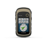
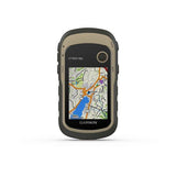
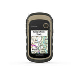
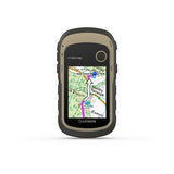
The Garmin eTrex 32x is the best budget buttoned GPS on the market.
It has a wonderful clear screen and the ability to put Ordnance Survey maps on it makes for a great companion for the four-season walker or cyclist.
This unit also comes pre-loaded with European mapping (please see FAQ's tab) so if you are also heading overseas a nice compact GPS to have with you.
The Garmin eTrex 32x is similar to the Garmin eTrex 22x except it has the addition of an electronic compass (to give improved accuracy) and it also has a barometric altimeter, giving you improved height data.
As with all the GPS units from GPS Training we don't just sell a box with a GPS in.
Overview of the Garmin 32x
eTrex 32x offer ease-of-use, durability and affordability that the eTrex handheld GPS series is known for along with preloaded TopoActive Europe maps. These devices are perfect for quad bikes, bicycles, boats or hiking.
- 2.2” sunlight-readable colour display with 240 x 320 display pixels for improved readability
- eTrex 32x adds a 3-axis compass and barometric altimeter
- Preloaded with TopoActive Europe maps with routable roads and trails for cycling and hiking
- Support for GPS and GLONASS satellite systems allows for tracking in more challenging environments than GPS alone
- 8 GB of internal memory for map downloads plus a microSD™ card slot
- Battery life: up to 25 hours in GPS mode with 2 AA batteries
----- ONLY AVAILABLE WHEN YOU PURCHASE YOUR GPS FROM GPS TRAINING -----
PLUS - We don't just sell you a box with a GPS unit in. In with the price we teach you how to use it via our online training course (online resource), give you free factsheets and training manuals (in with your unit) and are only ever an email or telephone call away if you ever need any help.
PLUS - All GPS units are kept in stock and are sent out Royal Mail Special Delivery, so it will be with you the next working day.
PLUS - We also will take your old GPS as a trade-in, to get a value for your GPS unit please click here.
Buy and Learn from the experts - GPS Training.
With this GPS purchase, you get our 'gold' support package for 1 year at no extra cost (see below) - worth £145.00


Features
See the Way
eTrex 32x offers enhanced 2.2”, 65K colour, sunlight-readable displays. Durable and water-resistant, these handhelds are built to withstand the elements.
Explore the Terrain
The eTrex 22x and 32x handheld devices come preloaded with road-routable TopoActive Europe maps that feature streets and trails so you can take the journey off the grid. Now you can know your surroundings — such as waterways, natural features as well as buildings, international boundaries and more. You can also find thousands of points of interests, including shops, restaurants, universities, car parks and accommodations.
Keep your Fix
The eTrex series uses both GPS and GLONASS satellite systems so the receiver has the ability to track in more challenging environments than GPS alone. eTrex 32x adds a 3-axis compass and barometric altimeter, making it easy for you to keep your bearings.
Satellite Imagery
Both devices support BirdsEye Satellite Imagery (subscription required), so you can download and integrate satellite imagery with your maps.
Find Fun
eTrex 32x support paperless geocaching. Upload GPX files straight to your device, and view key information such as location, terrain and hints from Geocaching.com.
Go Anywhere
With an array of compatible mounts, eTrex is designed as an outdoor handheld GPS ideal for use on quad bikes or bicycles, in boats or on foot. Use the auto mount capability and City Navigator® NT maps for turn-by-turn driving directions, or use the rugged mount for your motorcycle or quad bike.
Specs
General
Physical dimensions - 5.4 x 10.3 x 3.3 cm
Display size - 3.5 x 4.4 cm; 2.2" diag (5.6 cm)
Display resolution - 240 x 320 pixels
Display type - 2.2" transflective, 65K colour TFT
Weight - 141.7 g (with batteries)
Battery - 2 AA batteries (not included); NiMH or Lithium recommended
Battery life - 25 hours
Water rating - IPX7
Memory/history - 8GB
Sensors
Barometric altimeter - Yes
Compass - Yes
Maps & Memory
Preloaded maps - Yes (TopoActive Europe; routable)
Storage and power capacity - microSD™ card (not included)
Waypoints/favourites/locations - 2000
Routes - 200
Track log -10,000 points, 200 saved tracks
Outdoor Recreation Features
Area calculation
Automatic routing (turn by turn routing on roads) - Yes (with optional mapping for detailed roads)
Geocaching-friendly - Yes (Paperless)
Hunt/fish calendar
Sun and moon information
Picture viewer
In the box
In the Box
- eTrex 32x
- USB cable
- Documentation
Only from GPS Training you also get in the box:
- GPS Training getting started guide
- Getting started with Garmin BaseCamp factsheet
- Our 'gold' support package at no extra cost for 1 year - worth £145.00
Video
FAQ's
1. What batteries does the unit Garmin eTrex 32x?
2 x AA batteries
Purchase some good quality rechargeable batteries.
You can see the best batteries for the Garmin eTrex 32x.
2. What's the battery life on a Garmin eTrex 32X?
As per our answer to question 1, the eTrex32x unit is powered by 2 x AA Batteries, with good quality batteries as shown in our Video above you can achieve up to 25hrs battery life.
3. What are each of the map options available with the Garmin eTrex 32x?
This unit has Topoactive mapping on the internal memory and so this option comes as standard with any option you purchase. (Eg, if you purchase TOPO Great Britain Pro 1:50k, you will also get Topoactive mapping on the internal memory)
– Garmin eTrex 32x With Western Europe TOPO ACTIVE Mapping
Garmin TOPO ACTIVE mapping is a proper digital map, as you zoom in you get more information and as you zoom out you get less. BUT, it is not an Ordnance Survey map, therefore it does not differentiate between Bridleways and Footpaths, it just marks them as paths.
It covers 47 European countries, compiled using the community-generated OpenStreetMap (OSM) database. Coverage for: Albania, Andorra, Austria, Belarus, Belgium, Bosnia-Herzegovina, Bulgaria, Croatia, Cyprus, Czech Republic, Denmark, Estonia, Finland, France, Germany, Greece, Hungary, Iceland, Ireland, Italy, Kosovo, Latvia, Liechtenstein, Lithuania, Luxembourg, Macedonia, Malta, Moldova, Monaco, Montenegro, Netherlands, Norway, Poland, Portugal, Romania, Russia (Kaliningrad only), San Marino, Serbia, Slovakia, Slovenia, Spain, Sweden, Switzerland, Turkey, Ukraine, United Kingdom and the Vatican City.
– Garmin eTrex 32x with TOPO Great Britain Pro 1:50k - v3 (2024) - latest version
This is full GB at 1:50k mapping on a map card, which sits in the back of the GPS unit.
The TOPO PRO means that it is the latest map card from Garmin, giving you off road turn by turn routing within the National Parks, this means you can select a location many miles ahead and the GPS will route you via the footpaths to get to that location (like a car sat nav does).
Outside National Parks the GPS will navigate you in a straight line from waypoint to waypoint.
Don’t worry, here at the GPS Training we set the unit up for you so you can easily use these features and we even include a quick start guide so you can quickly get up and running with your GPS unit.
– Garmin eTrex 32x with TOPO Great Britain PRO 1:25k, 1:50k and 1:250k Ordnance Survey Map Card - v3 (2024) - latest version
This is full GB at 1:25k, 1:50k and 1:250k mapping on a map card, which sits in the back of the GPS unit. As you zoom in and out you pass through each of these three map sets.
The TOPO PRO means that it is the latest map card from Garmin, giving you off-road turn by turn routing within the National Parks, this means you can select a location many miles ahead and the GPS will route you via the footpaths to get to that location (like a car sat nav does).
Outside National Parks, the GPS will navigate you in a straight line from waypoint to waypoint.
Don’t worry, here at the GPS Training we set the unit up for you so you can easily use these features and we even include a quick start guide so you can quickly get up and running with your GPS unit.
3.1 Can you update the maps on the Ordnance Survey Map Card?
4. What kind of GPS does Garmin eTrex 32X have?
The Garmin eTrex 32x can lock out the American GPS System and also the Russian Glonass system.
Also the eTrex 32x also uses WAAS/EGNOS, enabling the unit to use Wide Area Augmentation System/European Geostationary Navigation Overlay Service (WAAS/EGNOS) data. these land-based systems will help improve satellite fix & accuracy when the unit locks onto them. - More info here
5. Can you use the Garmin eTrex 32x on a Bicycle ?
Yes you can there is a bike bar mount available for the Garmin eTrex 32x here and the pre-loaded Topo Active Mapping covering all of Europe has turn by turn routable data suitable for cycling.
6. What is the difference between the eTrex 22x and 32x?
eTrex 32x adds a 3-axis compass and barometric altimeter & ANT+ connection.


