

Garmin mapping options for outdoor GPS
In this short video we look at each of them in Garmin BaseCamp so you can see what each of them looks like and the differences between the different map sets for a Garmin GPS unit.
1. A look at the map options in Garmin BaseCamp
2. What map option is best for a Garmin GPS Unit?
The Garmin map options for a Garmin GPS Unit
1. Topo Active Europe Mapping
Compiled using the community-generated OpenStreetMap (OSM) database.
Includes routable street and off-road networks, international boundaries, waterways, natural features, land use areas, historical sites, airport structures, buildings and more.
N.B Not route-able on Roads for Cars / Motorbikes just Pedal Cycles.
Garmin Topo Active mapping displays thousands of points of interest, including shops; restaurants and bars; car parks; schools and universities and accommodations.
Garmin TopoActive Europe Mapping features detailed coverage of Albania, Andorra, Armenia, Austria, Belarus, Belgium, Bosnia and Herzegovina, Bulgaria, Croatia, Cyprus, Czechia, Denmark , Estonia, Faroe Islands, Finland, France, Georgia, Germany, Greece, Hungary, Iceland, Ireland, Italy, Kaliningrad (Russia), Kosovo, Latvia, Liechtenstein, Lithuania, Luxembourg, Macedonia, Malta, Moldova, Monaco, Montenegro, Netherlands, Norway, Poland, Portugal, Romania, San Marino, Serbia, Slovakia, Slovenia, Spain, Sweden, Switzerland, Turkey, Ukraine, United Kingdom, Vatican City.
- We find this TopoActive mapping on Garmin Fenix 7 series and Epix 2 series watches.
- In the handheld world it’s pre-loaded on the eTrex 22x, 32x, Touch 25 and 35, Oregon 750t, GPSMAP66st, 66i, 67 & 67i series, Montana 700, 700i and 750i. this you can use on it's own (GPS units that come with Topo Active maps) or use it alongside some Ordnance Survey mapping (both 1:50k and 1:25k Ordnance Survey maps).
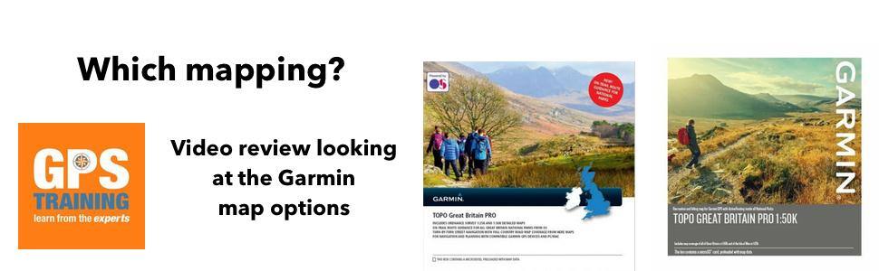
2. Garmin TOPO Great Britain PRO 1:50k – Full GB
This is Ordnance Survey mapping at 1:50k, equivalent to the Landranger Ordnance Survey maps, but these can be viewed on both your Outdoor GPS and your PC/ Mac, no need to buy the maps twice or pay a subscription. They are yours for life.
This mapping also has turn my turn routing within National Parks, don’t worry we set your new GPS unit up to utlise this feature and therefore it makes it nice and easy to use the turn by turn functionality that comes with the Garmin TOPO Great Britain PRO 1:50k
A real key feature on this map option from Garmin.
3. Garmin TOPO Great Britain PRO 1:25k – full GB
This is Ordnance Survey mapping at 1:25k, equivalent to the Explorer Ordnance Survey maps, but these can be viewed on both your Outdoor GPS and your PC/ Mac, no need to buy the maps twice or pay a subscription. They are yours for life.
The 1:25k Ordnance Survey maps on a Garmin GPS are more accurate than the 1:50k maps, they also show open access areas (right to roam) and permissive paths, which are not shown on the 1:50k Ordnance Survey maps.
This mapping also has turn my turn routing within National Parks, don’t worry we set your new GPS unit up to utlise this feature and therefore it makes it nice and easy to use the turn by turn functionality that comes with the Garmin TOPO Great Britain PRO 1:25k.
FAQ - How often do Garmin update their Ordnance Survey Maps?
The most common question we get asked is how often the Garmin Ordnance survey map cards get updated.
As you may know Ordnance Survey tend to release 1/4 of the GB every year as a map update, therefore Garmin update their Ordnance Survey map cards approx every 3 - 4 years.
Where are we in the Garmin Ordnance survey map card cycle?
1:25k TOPO PRO v3 map card - this Garmin 1:25k Ordnance survey map card was last updated at the end of December 2023, so we would expect the next map card update to be approximately around early 2026.
1:50k TOPO PRO v3 map card - this Garmin 1:50k Ordnance survey map card was last updated at the end of December 2023, so we would expect the next map card update to be approximately around early 2026.
Garmin tend to receive the Ordnance survey map updates approx every 3 - 4 years, but it does take them a couple of months to update the physical Garmin map card and for these to filter through to retailers.
Thankfully here at GPS Training we sell through our stock every week so once the new map card is released we will have it, I am aware that some other retailers do hold massive stock in warehouses and it means that they are selling the old map card with GPS units for many months after when they should have been.
Other articles about Garmin GPS mapping you may find interesting
1. Raster v Vector maps for the UK GPS user
2.Garmin Ordnance Survey mapping now with Routable Trail Data within the National Parks
3. Do I need OS maps on an Outdoor GPS unit?