Skip to content
Search
Home
GPS Store
Handheld GPS Units
Two-way satellite communication
GPS Watches
Maps
Accessories
Power and Batteries
Headtorches and torches
Map and Compass
GPS Support Packages
Gift voucher
GPS Training Courses
Garmin Classroom Based Courses
Garmin - South Downs
Garmin - Peak District
Garmin - Northumberland
Garmin - Northamptonshire
Garmin - New Forest
Garmin - Lake District
Garmin - Gloucestershire
Garmin - GPS in the Hills - Nationwide
Online Courses
Online Resource (online self led training course)
Group GPS Training over Zoom
1:1 Remote online training - over Zoom - GPS unit
1:1 Remote online training - over Zoom - Route planning software
Course Calendar
Online Resource
OS Planner
Product Reviews
News
Contact
Site navigation
Search
Search
Cart
Menu
Site navigation
Home
GPS Store
Handheld GPS Units
Two-way satellite communication
GPS Watches
Maps
Accessories
Power and Batteries
Headtorches and torches
Map and Compass
GPS Support Packages
Gift voucher
GPS Training Courses
Garmin Classroom Based Courses
Garmin - South Downs
Garmin - Peak District
Garmin - Northumberland
Garmin - Northamptonshire
Garmin - New Forest
Garmin - Lake District
Garmin - Gloucestershire
Garmin - GPS in the Hills - Nationwide
Online Courses
Online Resource (online self led training course)
Group GPS Training over Zoom
1:1 Remote online training - over Zoom - GPS unit
1:1 Remote online training - over Zoom - Route planning software
Course Calendar
Online Resource
OS Planner
Product Reviews
News
Contact
Search
Search
Cart
Item added to cart.
View cart and check out
.
Close
Close
FREE UK delivery for orders over £50.00 and FREE Gold Support package with any GPS/ Watch purchase (worth £145.00)
Close
Handheld GPS Units
Handheld GPS units. The best Outdoor GPS units for all budgets. A wide range of the best handheld GPS units for walking, hiking, mountain biking, running, and watersports.
Filter by
All
eTrex SE
eTrex Solar
eTrex10 2* & 3* Series
Garmin
Garmin Montana 700 Series
Garmin Montana Series
GPSMap Series
GPSMap67 Series
inReach
Solar
Two-way satellite communication
TwoNav
Unit
Sort by
Featured
Best selling
Alphabetically, A-Z
Alphabetically, Z-A
Price, low to high
Price, high to low
Date, old to new
Date, new to old
Garmin eTrex SE
Regular price
£130
Sale price
£128.99
Sale
View
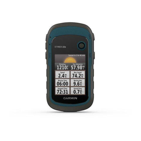
Garmin eTrex 22x
On sale from £168.99
Sale
View
Garmin eTrex Solar
Regular price
£220
Sale price
£199.99
Sale
View
Garmin eTrex 32x
On sale from £218.99
Sale
View
TwoNav Cross Plus
On sale from £269.99
Sale
View
TwoNav Terra
On sale from £299.99
Sale
View
TwoNav Roc
On sale from £299.99
Sale
View
TwoNav Cross Plus - Larger Memory - 64gb
From £299.99
View
Garmin GPSMAP 65
On sale from £324.99
Sale
View
TwoNav Terra - Larger Memory - 64gb
From £339.99
View
Garmin GPSMap 65s
On sale from £344.94
Sale
View
Garmin GPSMAP 67
On sale from £429.99
Sale
View
TwoNav Aventura 2 Plus
From £429.99
View
TwoNav Aventura 2 Plus Motor
On sale from £459.99
Sale
View
Garmin GPSMAP 67i
On sale from £499.99
Sale
View
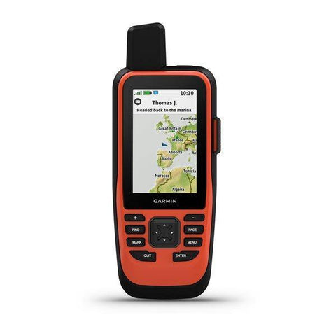
Garmin GPSMAP 86i
On sale from £519.99
Sale
View
Garmin Montana 710
On sale from £599.99
Sale
View
Garmin Montana 710i
From £729.99
View
Garmin Montana 760i
On sale from £799.99
Sale
View
Choosing a selection results in a full page refresh.
Press the space key then arrow keys to make a selection.
Use left/right arrows to navigate the slideshow or swipe left/right if using a mobile device